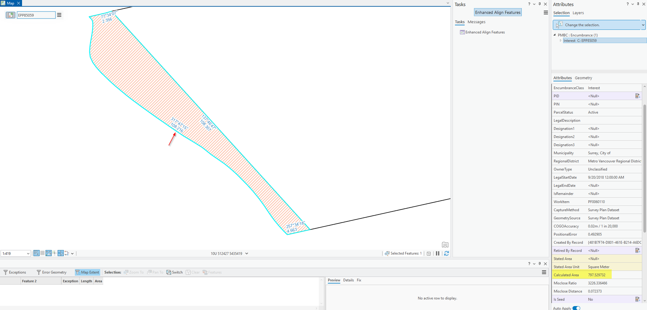
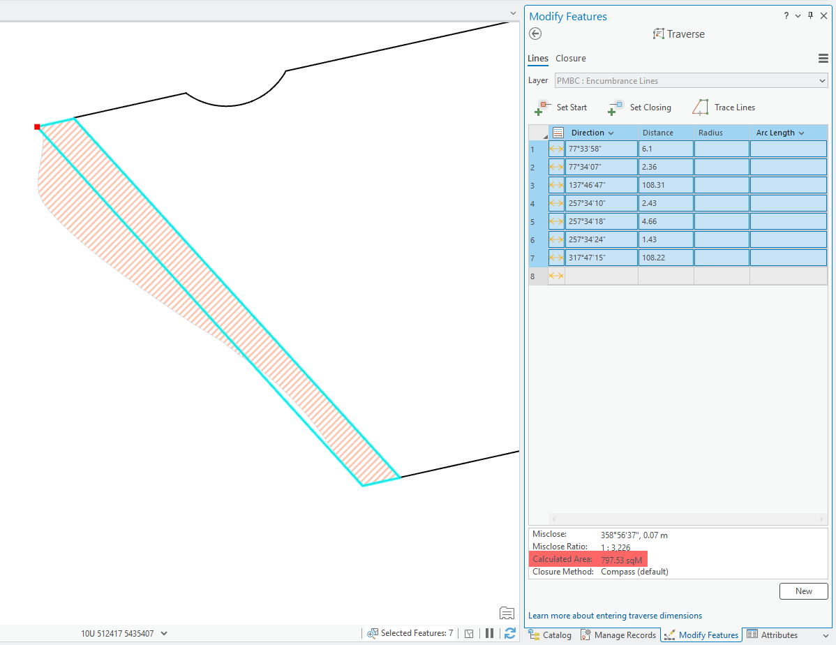
In ArcGIS Pro, parcels bounded by LineStrings (used for natural boundaries) don’t have their calculated areas computed correctly.
For example:
- This parcel is approximately 1,210 sqm according to the survey plan.
- When part of a parcel (or all, such as an island) is built from LineString, the calculated area on the parcel is calculated incorrectly. This happens because the COGO distance on the LineString is calculated as the straight-line distance between the start and end points — ignoring the true shape of the boundary.
- Our current workaround is to remove COGO from the LineString features, which results in no calculated area being displayed. While this avoids showing an incorrect area, it’s obviously not ideal.
Idea / Enhancement Request:
It would be extremely helpful if ArcGIS Pro could correctly calculate parcel areas that include LineStrings as boundaries — accounting for their geometry properly, rather than using straight-line COGO distances.
This enhancement would allow cadastral users who work with natural boundaries to maintain accurate parcel areas without manual correction or loss of calculated area information.