Hello everyone!
I'm brainstorming a scenario and the best way to address it - I'm working with a professor that has a line file that needs a spatial join with a polygon layer. Easy enough, however, we're running into an issue (that I was expecting to happen) - many of the lines are overlapping with the polygon boundaries so I'm trying to reconcile that.
For example, I ran the intersect to see where the spots are where the line overlaps with the polygon boundary. A point represents every part of the line that zig zags over the polygon boundary. The polygon boundary is highlighted in pink and the line is purple:
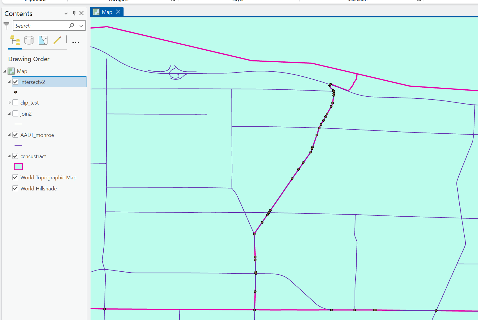
If it was a typical situation, I would split the lines at the points, and then it would give me a little more accurate count if I ran the spatial join and where it is located with the polygon. But I know in this case, the overlapping lines are a bit of a sticking point.
Any recommendations? I need to create some type of join between the lines and polygons, but there isn't a common field in either dataset. There are also many lines over one polygon, and one line can stretch multiple polygons. Ideally, I need some kind of table where it's one polygon (census tract in this case) with an entry for each line. Or just some why to create a tie between the layers when they only share a spatial relationship and no shared attributes.
To be honest - I'm not sure if there is much I can do about it, there is probably going to be some type of margin of error, but just exploring possibilities.
Also, something that does not involved writing a script please!
Thank you!





