Hello,
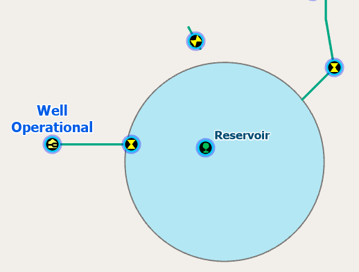
I am creating our water systems subnetworks (UN version 7) and realized I may need to add associations to our utility network for some of our isolated water areas to be represented correctly. In one case we have an isolated area that has water from a well into a reservoir tank, pumped through a booster station and delivered directly to the residents. I wanted to use the well as the subnetwork controller. I have the well point, the tank point, and the water lines, but I am assuming I should connect them through associations as they don't physically connect in GIS. (Unless the more simple solution is just to extend the water pipes through the tank site to the tank point to achieve connectivity). I haven't worked with associations yet, so I am a little stuck on how to proceed. If using associations is the correct way to model this situation, do I use the import associations tool to create the associations table? If yes, does anyone have example data of how to correctly populate the csv file for that tool? Open to other suggestions as well for what would be the best practice for this scenario.
Thank you!




