I've developed a toolbox a couple of months ago, prior to 3.5.0 update, that completes a simple task.
It's as simple as importing boundaries from the Living Atlas portal and performing a spatial join then clip.
HUC_06_layer_url = 'https://services.arcgis.com/P3ePLMYs2RVChkJx/arcgis/rest/services/Watershed_Boundary_Dataset_HUC_6s/FeatureServer/0'
        arcpy.management.MakeFeatureLayer(HUC_06_layer_url, "HUC06")
HUC_10_layer_url = 'https://services.arcgis.com/P3ePLMYs2RVChkJx/arcgis/rest/services/Watershed_Boundary_Dataset_HUC_10s/FeatureServer/0'
        arcpy.management.MakeFeatureLayer(HUC_10_layer_url, "HUC10")

arcpy.analysis.SpatialJoin(
            target_features="HUC06",
            join_features=installation_A_directory,
            out_feature_class=HUC06_Out,
            join_operation="JOIN_ONE_TO_ONE",
            join_type="KEEP_COMMON",
            field_mapping=None,
            match_option="CONTAINS",
            search_radius=None,
            distance_field_name="",
            match_fields=None
        )
arcpy.analysis.Clip(
                in_features="HUC10",
                clip_features=HUC06_Out,
                out_feature_class=HUC10_Out,
                cluster_tolerance=None
            )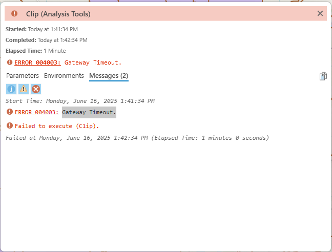
This has never happened before when running this tool prior to the 3.5.0 update. I recently applied the update and ran this tool for the first time afterwards. I know the HUC06 and 10 boundaries contain a lot of information and ESRI recommends clipping with a smaller data. I had no issue running the tool with various data (in terms of spatial join). Even performing the task with pairwise clip isn't working. Manually clipping (not my tool, but the clip geoprocessing tool) isn't also working. One resolution I came up with was to set the processing extent (in the environment tab) and limit the X and Y extents. This, however, doesn't always work.
Any idea why this keeps happening?
Thanks in advance!

