Hi everyone,
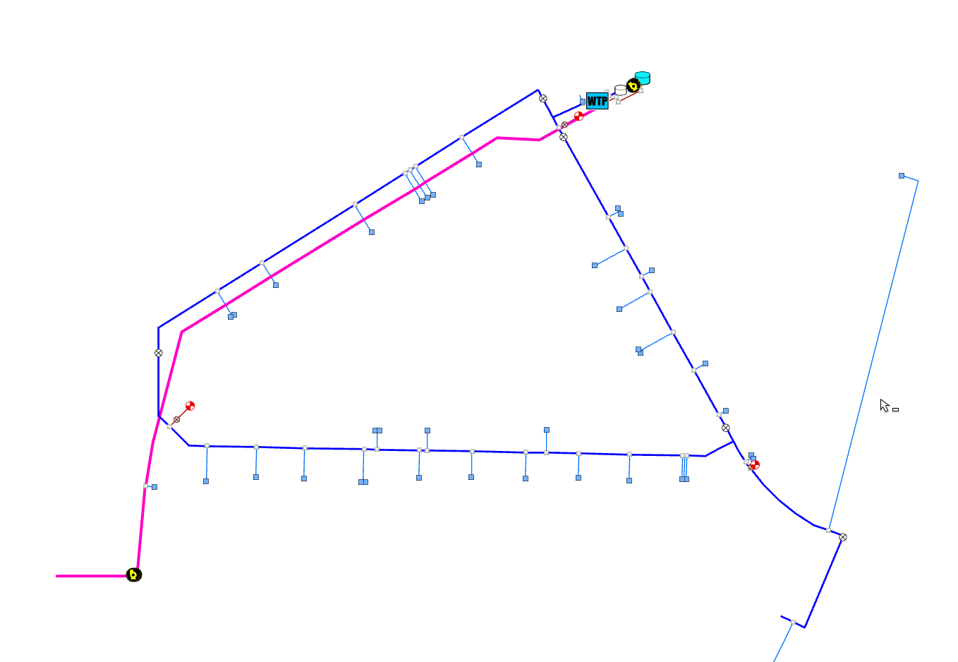
I am currently in the early process of deleting and updating subnetworks in our utility network. When reviewing this documentation, I run into problems at the last step. Using the water system shown below, I have removed all subnetwork controllers. Then I validate the extent and get no errors and no dirty areas display within the error inspector. Then I update the subnetwork using the find subnetwork pane or geoprocessing tool successfully. When I run the export subnetwork too, the tier parameter says that there are no clean subnetworks discovered.
Can anyone give me some guidance on how to setup a system and pressure subnetwork on the below water system? Generally speaking, the pink line pumps water from a river to a treatment plant and the pumps to distribution. Does there need to be an asset that serves as a subnetwork controller at the beginning of the pink line to represent the supply (river)? If I set the pumps at the plant as subnetwork controllers for a pressure subnetwork, all assets are assigned to the system subnetwork. Wouldn't you think that everything after the pumps would be the pressure subnetwork?
Overall, what assets do you use as subnetwork controllers within a water utility network? For example, the esri default Naperville water data uses a water treatment plant as the controller for the system subnetwork. For us, the treatment plant is an area that contains several assets which could control a subnetwork. How do you handle wells that feed a treatment plant? What about bodies of water that serve as a source for a system?
I've gone through most of the content within this documentation, but have had a difficult time applying it to our utility network. Any help regarding subnetwork management would be greatly appreciated!