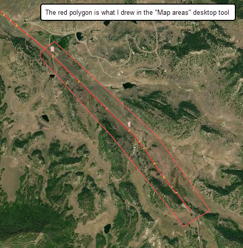
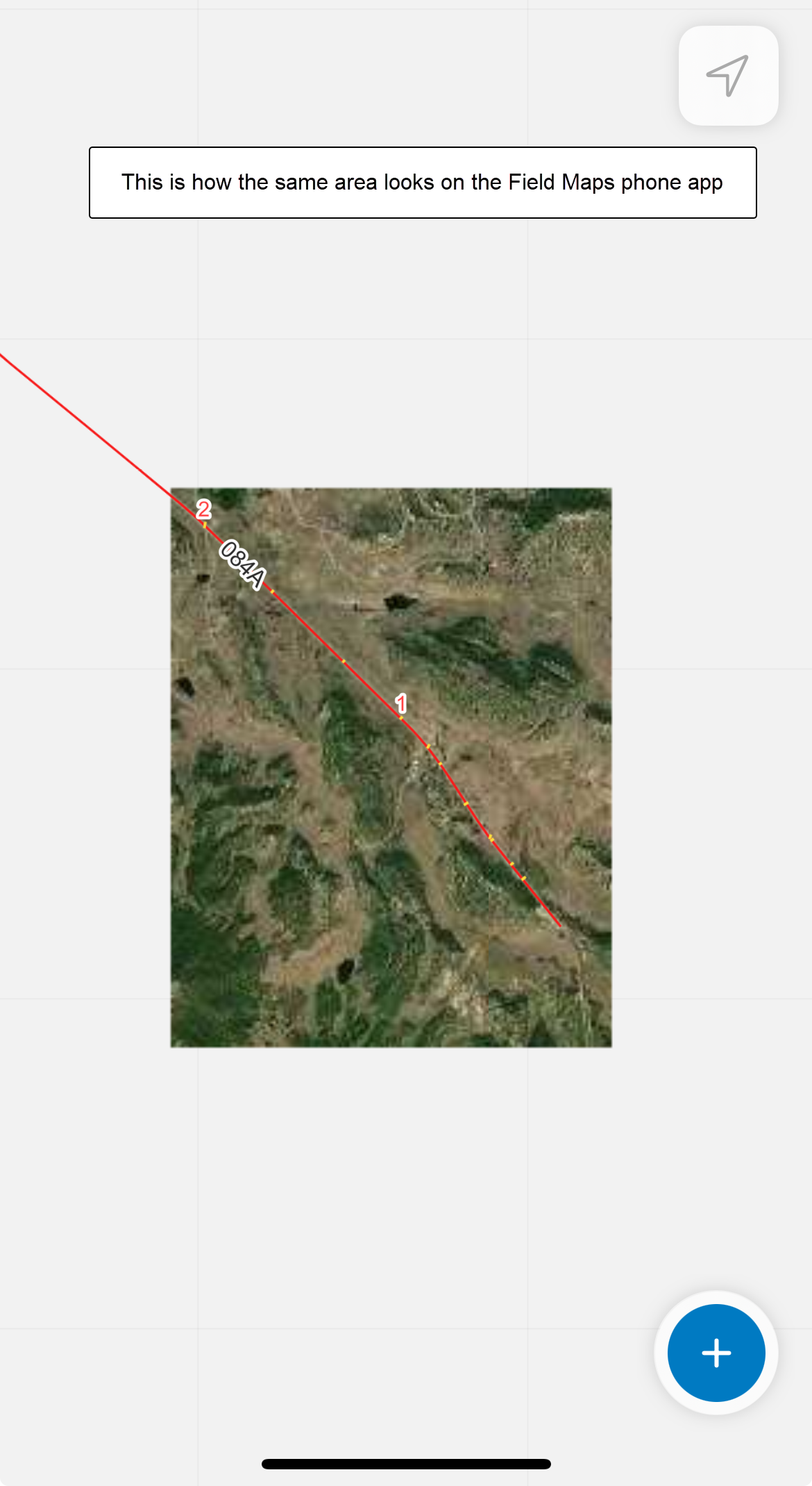
I'm trying to create offline maps for field crews in an area with no reception.
The area I'm trying to capture is not a perfect rectangular (I'm capturing areas around roads, linear events), so I'm using the "Sketch polygon map area" option to capture my area.
But each time the results (the offline map) come back as a rectangular shape, with 4 vertices, and not the original shape I drew on the map. See images below.
It appears that the tool picks 4 vertices from the odd rectangular shape I created and extrapolate it to a 4-corner rectangular.
Is this a bug in Field Maps? Or am I doing something wrong? I'm on enterprise 11.1