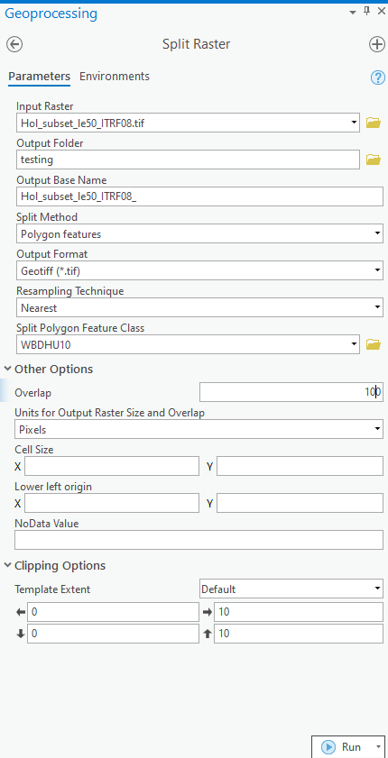
We are trying to split a raster (DEM) into chunks based on boundaries in a polygon feature class (hydrologic units). We'd like the raster chunks to be larger than the polygon boundaries so that each chunk overlaps each other slightly. It sounds like the Overlap option in the Split Raster tool should so this. The screenshot below shows what we entered for the tool, specifying a 100 pixel overlap. However the rasters output from the tool follow the polygon boundaries and have no overlap with adjacent polygons. Either the tool is not working correctly or I'm not understanding how the Overlap function really works. I found an older post with this same question here, but it was not solved. I cannot find any more details about the Overlap option other than what is on the ESRI help page.
We are using ArcGIS Pro 2.6.1. The Snap raster is set to the Input Raster. Both the raster and the polygon features are in the same coordinate system & datum.
Is the Overlap option meant to produce essentially "buffered" output rasters? If so, what are we doing wrong?
If not, what does the Overlap function do?