Hi,
I am trying do use Esri's Land Cover Classification model on aerial images in ArcGIS version 3.0.2.
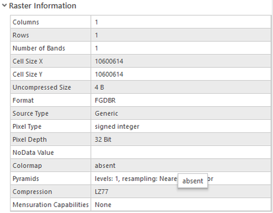
Whenever I run the tool the process is completed but the output layer is empty. I have tried running it with different input layers, models and parameters but the result is always the same. Every time the process goes to 2 % and than skips to 'Generating raster' stage. What's weird is that the output layer has 1 row, 1 column and 1 channel.
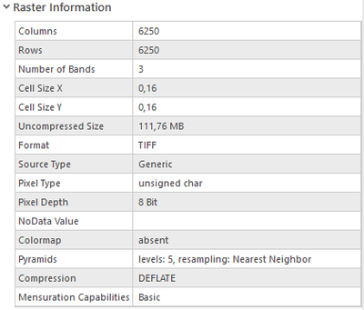
Input raster information:
Output raster information:
Any help would be appreciated.


