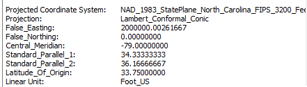
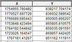
Hi all, I need your help! I recently did some geocoding of addresses in ArcMap where I had to manually match over 200+ records and the output gave me these x & y's. Anyone have any idea how I can rectify this and get it in DD?
My map is in NAD_1983_StatePlane_North_Carolina_FIPS_3200_Feet
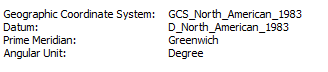
Geographic Coordinate System: GCS_North_American_1983.
The feature class is in: