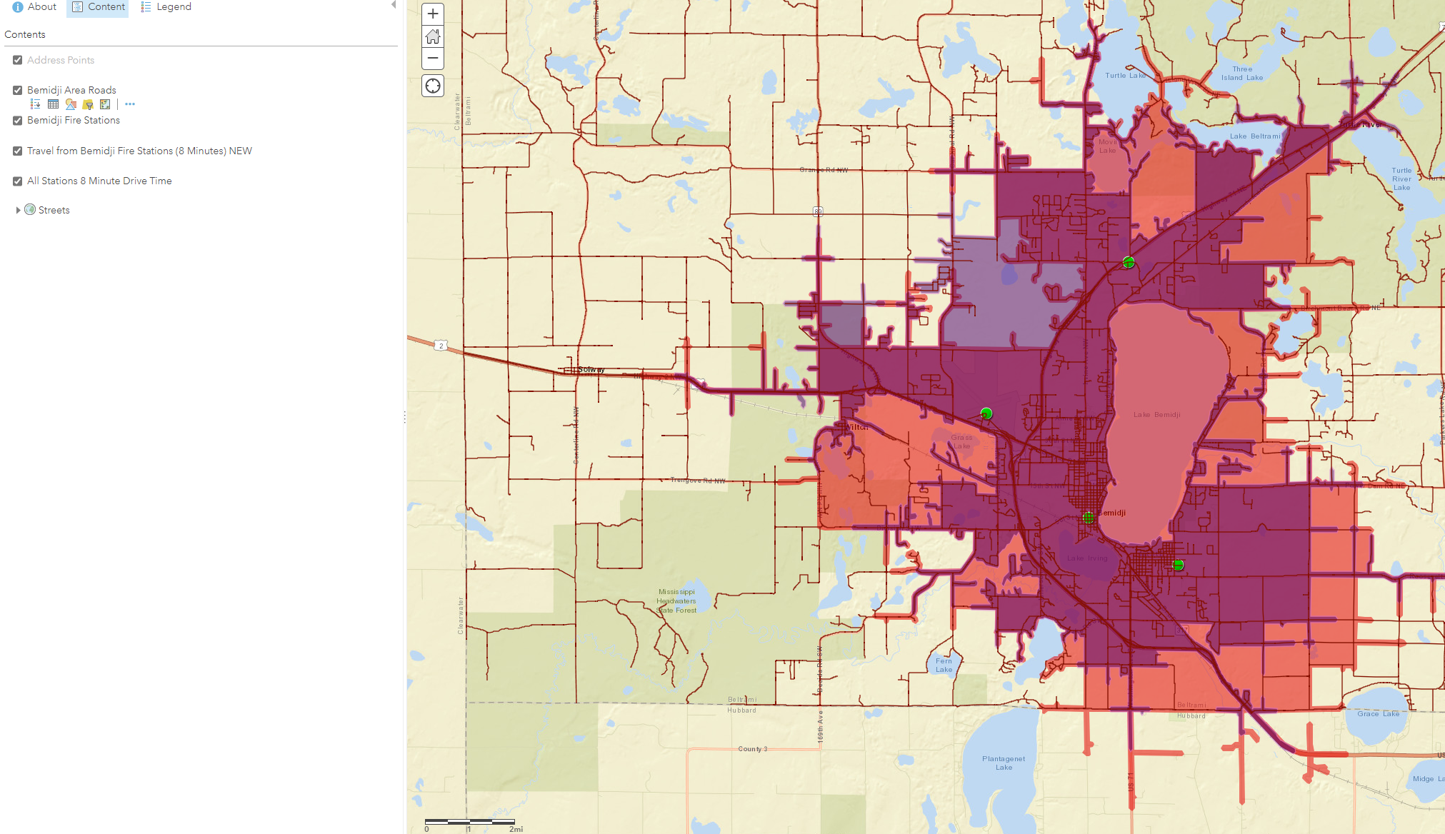
I'm trying to create a Drive Time maps from our four Fire Stations because our fire fighters need to live within an 8 minute drive time to a station.
I followed the instructions from Tech Support: How To: Create a Drive-Time Area and Find the Radius Distance from a Single Point (esri.com)
This was done by my predecessor a few years ago and my results seem quite different in certain areas. In some instances, the new distances are longer and in others the old are longer. There haven't really been any road changes that would affect what I'm seeing either. I was wondering if anyone knows how this is really calculated and why I might see these large differences in some areas? (just so I can explain it to stakeholders)