Hi! I am new in Drone2Map and need help with image processing. I have processed my images and got the wrong elevation in my DSM/DTM. I tried different coordinate settings. For example, the altitude of the processing images is about 98 meters and the value of the DTM is about -5 to -20 meters for these settings:
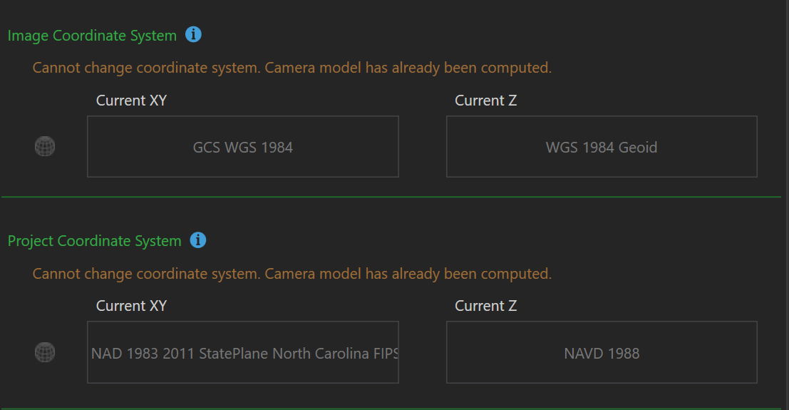
Another example: DTM elevation from -11 to -61 USft for these coordinate settings.
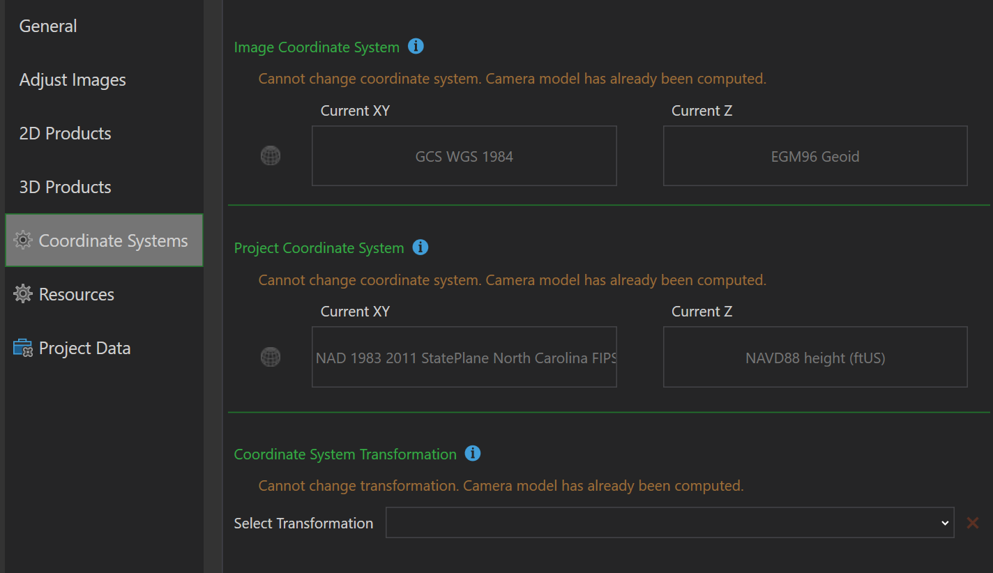
The rial terrain elevation is about 325-304 US ft or 99-92 meters.
I have checked the camera settings. It looks correct. The ground-controlled points are not applied. Please, help.





