I work for a telecom and have been working on using ArcGIS Pro for our engineers to design our construction builds. I have been using the strip map index tool to create the print areas for our construction sheets for the prints that will be handed to contractors. Those print areas will be used in a Map Series Layout. It has been working well, but there is one problem with not being able to say a start or end point. This causes the pages to start in the middle of the network design.
Any ideas on how I can still use a map series for the prints, but have more control on where page 1 lands in the project?
Here is an example:
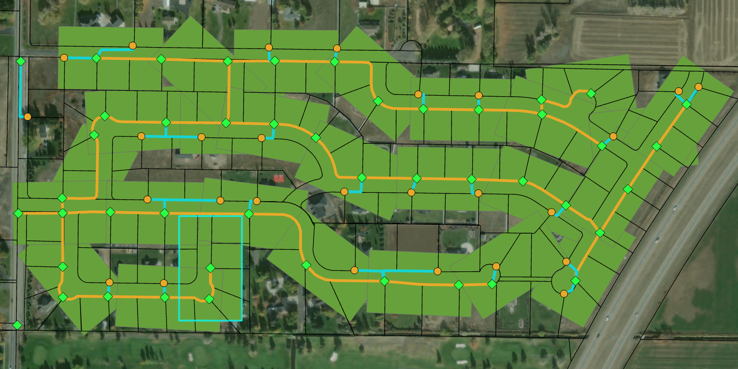
I have selected pg.1 of the strip map index but it is located at the middle of design as shown above.
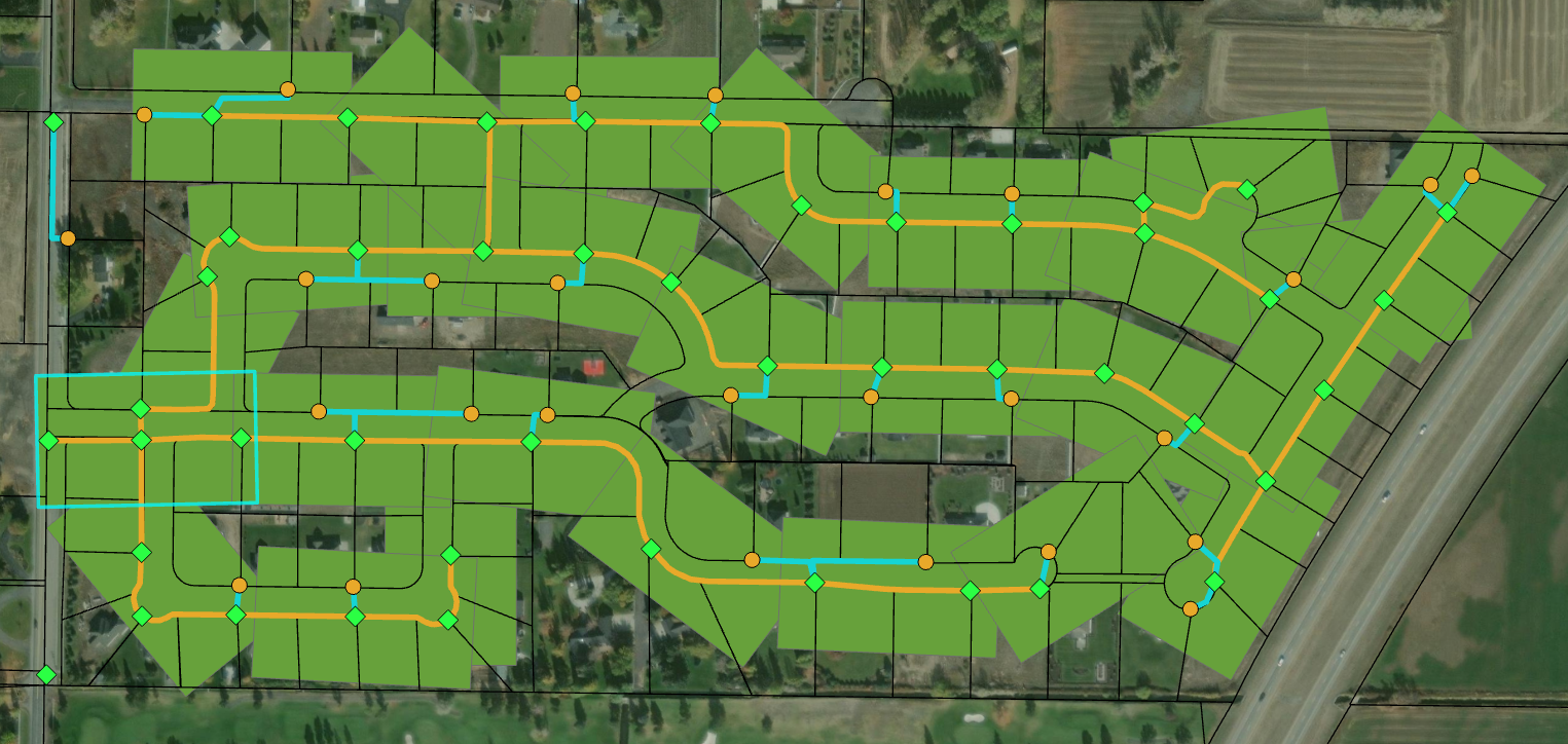
I need pg. 1 to be the one I have selected above, but it has given this one the value of pg. 22

