Hello. I am trying to load rasters into ArcGIS Pro Desktop, but the land use classifications are not appearing; instead I am seeing RGB (Red Green Blue) bands when I load the rasters.
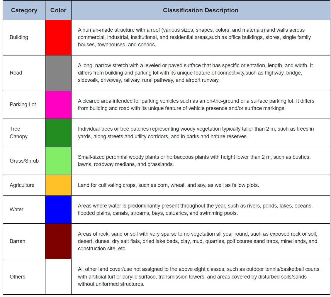
For context, I am using great publicly available 1m by 1m raster land use data by Univ of North Carolina (https://urbanwatch.charlotte.edu/product). Here are the land use classifications:
and here is the image of one of the .tif files when I just open it up on my computer as a photo:
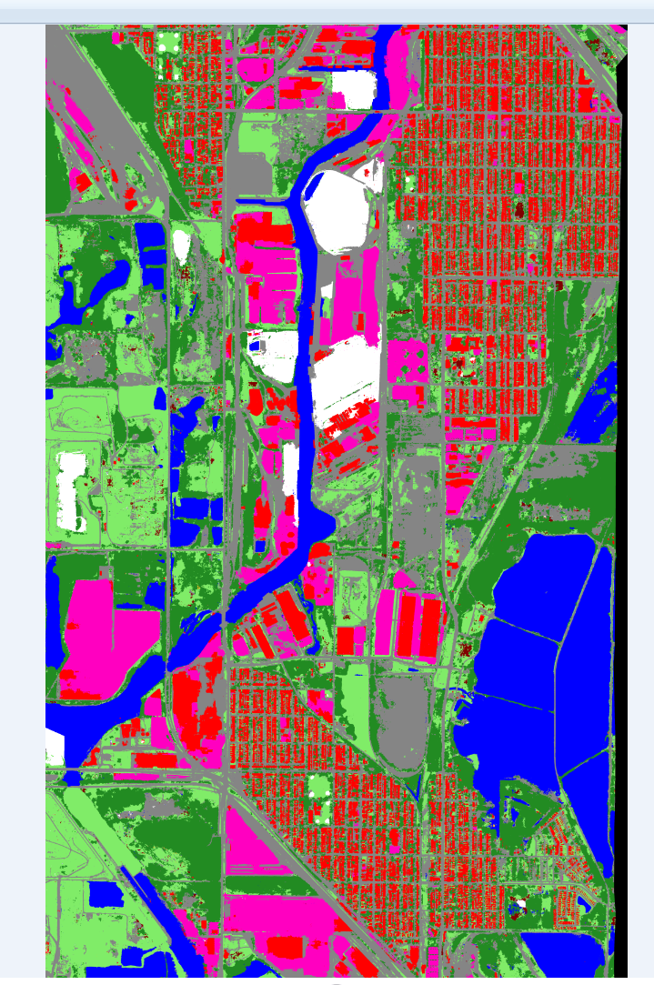
As you can see, there are a variety of colors representing the different land classes. Theoretically, I should be able to load this .tif and then click on an area and uncover the land class.
But when I load in the .tif files, they are showing up as RGB, shown here:
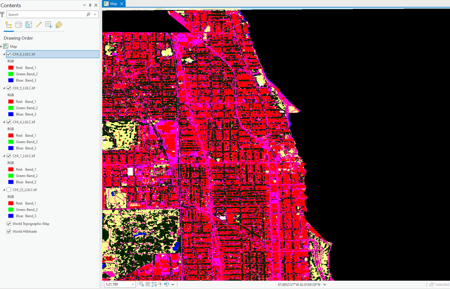
Is ArcGIS Pro Processing the .tif's incorrectly? How can I get these classifications to appear?
Thank you for your support and time.



