Using Arcgis Pro 2.9.1, Python API 1.9.1
I've been trying to do some work with spatially enabled frames using the spatial (geometry) properties. In this work I've seen that these operations are incredibly slow. For example a Pandas operation such as
sedf['wkt'] = sedf['SHAPE'].spatial.WKT
takes over 7 hours for a approximately 700,000 row dataframe. Other Pandas operations run in seconds. One hypothesis is that the spatial data frame is not using vectorized operations.
Another issue with the WKT is returning the correct coordinate values.
In the graphic, the areas shown in purple is correct, the area shown in green are the values returned by the WKT property.
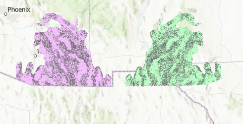
This is after have to remove the negative '-' signs from the returned WKT values.

