We have ArcGIS Enterprise Portal 10.7.1.
I am searching for strategies to improve the efficiency of mapping large datasets and found a technique called Coordinate Quantization. According to the ArcGIS REST APIs documentation - Layer (Feature Service), it said:
"For 10.6.1 version, New layer properties exposed on a feature service layer:
supportsCoordinatesQuantization is true if a layer supports coordinate quantization."
https://developers.arcgis.com/rest/services-reference/enterprise/layer-feature-service-.htm#ESRI_SECTION2_DF270F2108A54B3F99E8F1B67C3C3C83
I assumed that coordinate quantization can also be applied in the feature layer published on ArcGIS Enterprise Portal 10.7.1.
We shared a web feature layer that references registered data to ArcGIS Enterprise and added the feature layer to a web map (view in Map Viewer Classic). However, it seems that no coordinate quantization is applied. The query returned are the absolute coordinates of the geometry.
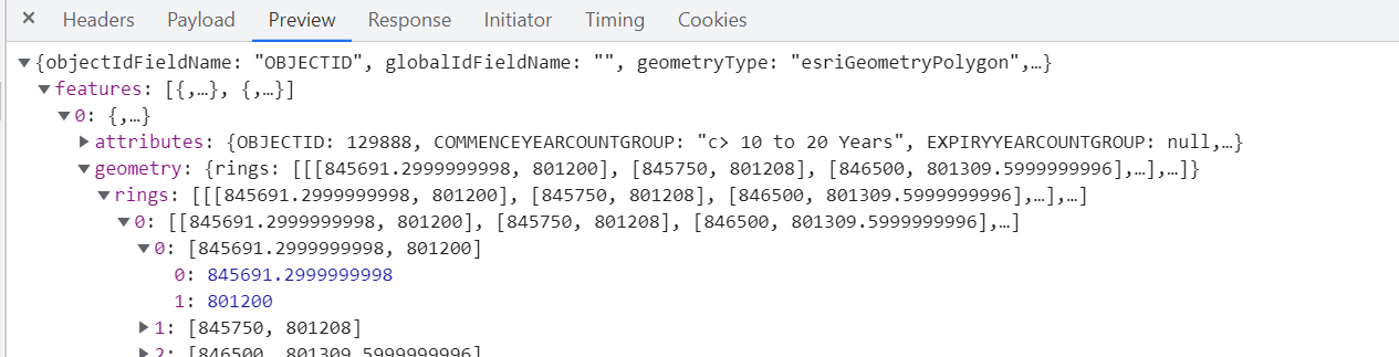
I have checked that the supportsCoordinatesQuantization is true from the URL of my feature service.

May I know how can I enable the coordinates quantization in ArcGIS Enterprise Portal 10.7.1? Is coordinates quantization supported in the web feature layer that references registered data? Thanks!

