Hello all,
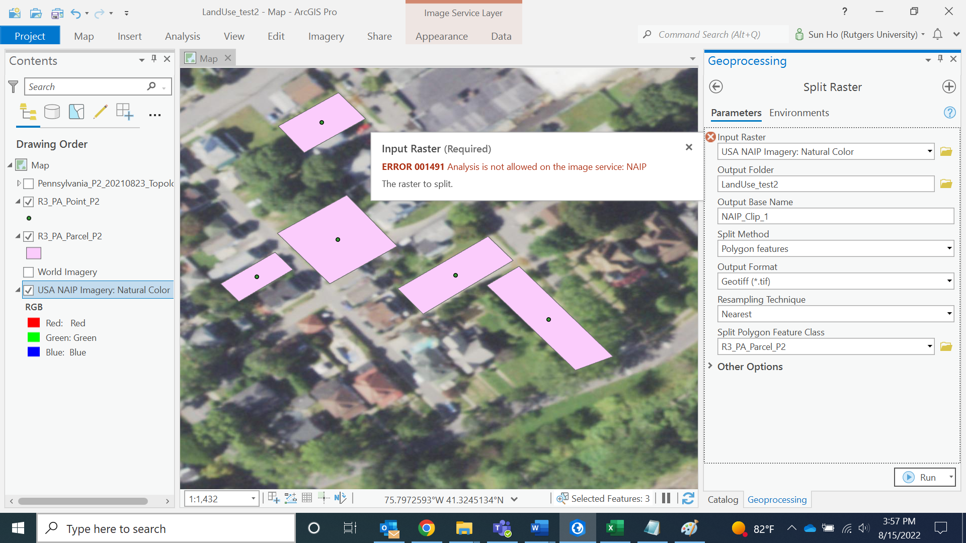
I found high-resolution satellite image data called NAIP from the Live Atlas and downloaded "USA NAIP Imagery: Natural Color." Now I have parcels(polygon) that I want to clip with, so trying to use the "Raster Split" tool. But as shown in the below image, the analysis of the image service seems to be locked.
Is this normal for all image data from Live Atlas? are they simply for visualization purposes?
Or is there any way to export NAIP to a raster so I can edit it?
Thank you!

