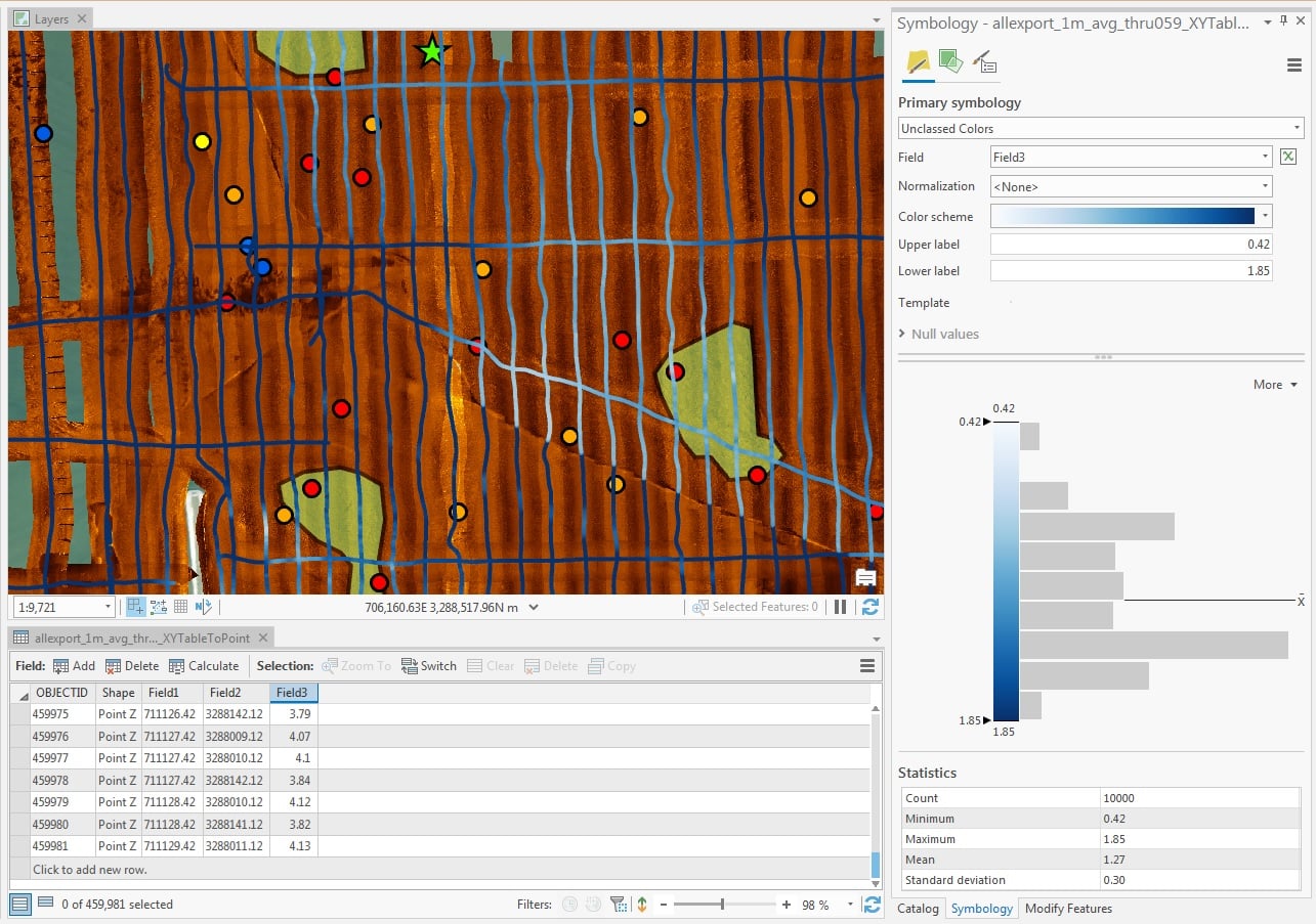
I'm using ArcGIS Pro 2.7.3. I've imported a large single-beam XYZ bathymetric point file into my project (using an exported CSV file). All of the points (close to 50,000) are displayed correctly and visible in the attribute table, but it appears that only the first 10,000 points have been used for developing the symbology (and the underlying statistics). Is there some way that I can I enable all of the points to develop the proper symbology or do I need to create a much reduced point file? I am a sporadic and self-taught user. Thanks.