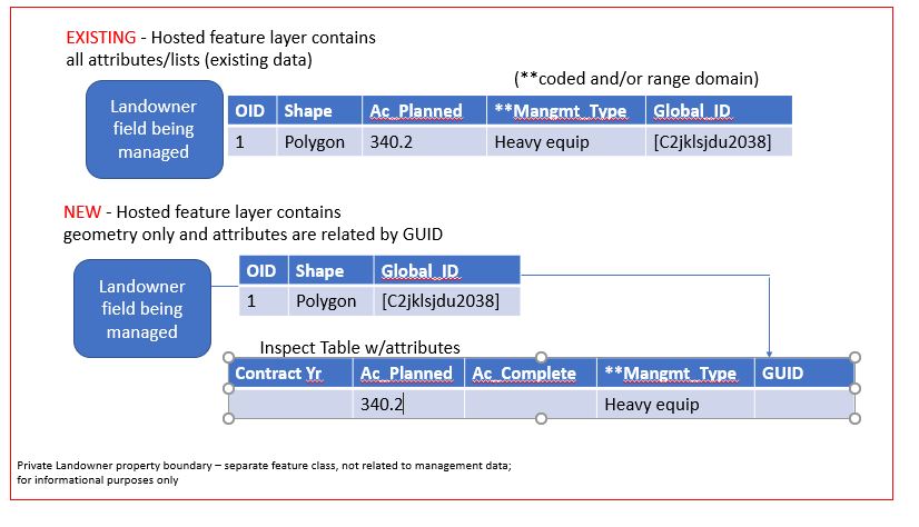
Hi, I manage a multi-user project which tracks management practices performed on private lands. We started from scratch, not knowing how this would work in AGOL or Collector but now have 9 hosted feature layers containing data which have been working pretty well. Recently I received a request to add a field for contract year because some of the parcels will be managed cyclically, i.e. burned every 2 years. But to account for multiple years of managing one parcel area (portion of a landowner's property), I know no other way to accomplish this except through related tables with a one (area) to many (recurring burns/management practices) cardinality. QUESTION: What is the best approach? Do I separate each feature layer's geometry and attributes manually and then relate them? So far I have not been able to get this to function properly. Each parcel area record has a global id but how will this be preserved in the relationship class? The GUID field, required for Collector as described in How to Set Up Related Tables for Collector needs to remain blank to successfully create the relate. I also have lists created in the management types to further define the attributes. I have provided a simple sketch of where I am and where I THINK I am headed but I could certainly use some advice before transitioning to Field Maps. Thank you. Kristal