- Home
- :
- All Communities
- :
- Products
- :
- Imagery and Remote Sensing
- :
- Imagery Questions
- :
- Why is my video footprint not showing up?
- Subscribe to RSS Feed
- Mark Topic as New
- Mark Topic as Read
- Float this Topic for Current User
- Bookmark
- Subscribe
- Mute
- Printer Friendly Page
Why is my video footprint not showing up?
- Mark as New
- Bookmark
- Subscribe
- Mute
- Subscribe to RSS Feed
- Permalink
- Report Inappropriate Content
I am using metadata (attached) along with some aerial drone video. The speed I am using is in mph and the altitude is in meters. I am not sure if I should change speed to km/h to keep the SI units consistent. This is probably not the reason for my issue though. If I had to wager, I would guess that maybe some of my values in the metadata are not conforming to MISB standards, but I have looked through multiple times and can't find any discrepancies. Also, it is not a software problem since I have been able to successfully get a video footprint with the FMV tutorial video and metadata. The lat and lon of the video is correct but there is no footprint (see image below). I have tried multiplexing other videos with similar metadata set ups and have been unsuccessful thus far. I would appreciate any assistance. Thank you.
- Mark as New
- Bookmark
- Subscribe
- Mute
- Subscribe to RSS Feed
- Permalink
- Report Inappropriate Content
Hi James,
The problem is that all of your timestamps has the same value. They're all 1571940000000000. The problem is that since they're all the same, there's no way to sequence them. This is usually because Excel will convert all the values to scientific notation and only a few significant digits, so it will save it as 1.57194e15 or something similar.
You'll have to gather up your original data and make sure Excel never eats your last digits. The way to make sure it never eats them is to change the formatting to "Number" with 0 decimal places. There's a screenshot in the tips and tricks page about how it should look. Note that since Excel has already eaten that data, you'll have to grab your data from an earlier stage.
Video Multiplexer Tips and Tricks to format your metadata
Good luck,
-Nick
- Mark as New
- Bookmark
- Subscribe
- Mute
- Subscribe to RSS Feed
- Permalink
- Report Inappropriate Content
Hi Nick,
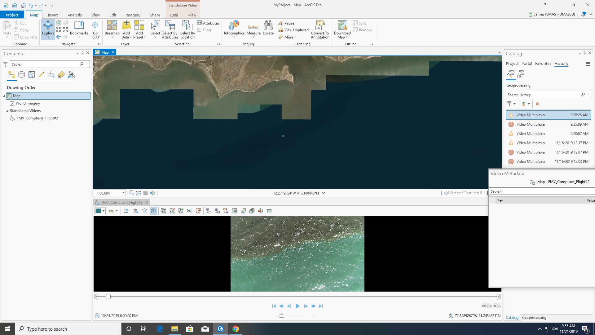
Thank you for your response. I am familiar with having to have the excel file saved with decimal set to 0. However, whenever I do that (1) and reopen the document (2), it doesn't have that same format. However, it does seem like the correct timestamp (3) is being loaded and multiplexed (4) with the video. The video metadata pane in (5) and (6) show that the UNIX time is varying. I am wondering if there could be any other issues with the metadata I am using.
Thank you,
James
1:

2:

3:

4:

5:

6:

- Mark as New
- Bookmark
- Subscribe
- Mute
- Subscribe to RSS Feed
- Permalink
- Report Inappropriate Content
Ok, so it looks like the metadata itself is sorted out. Now you need to add an elevation source.
You can add an elevation source to the map, using Map->Add Data dropdown->Elevation source.
Alternatively, you can run the multiplexer with a data source, by adding an elevation source into the Digital Elevation Model box. Since your video takes place mostly over the ocean, you could also just type 0 meters into that box.
Note that we don't really have a way to deal with tides at the moment, so that's something to keep in mind.
-Nick
- Mark as New
- Bookmark
- Subscribe
- Mute
- Subscribe to RSS Feed
- Permalink
- Report Inappropriate Content
James
have you tried viewing your multiplexed video in a 3D scene? It includes an elevation layer (our cached 3D elevation service) by default.
Cody B.