- Home
- :
- All Communities
- :
- Products
- :
- ArcGIS Pro
- :
- ArcGIS Pro Questions
- :
- Vector Field Symbology questions
- Subscribe to RSS Feed
- Mark Topic as New
- Mark Topic as Read
- Float this Topic for Current User
- Bookmark
- Subscribe
- Mute
- Printer Friendly Page
- Mark as New
- Bookmark
- Subscribe
- Mute
- Subscribe to RSS Feed
- Permalink
- Report Inappropriate Content
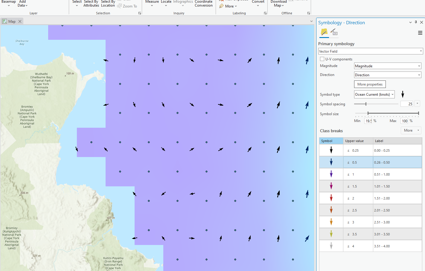
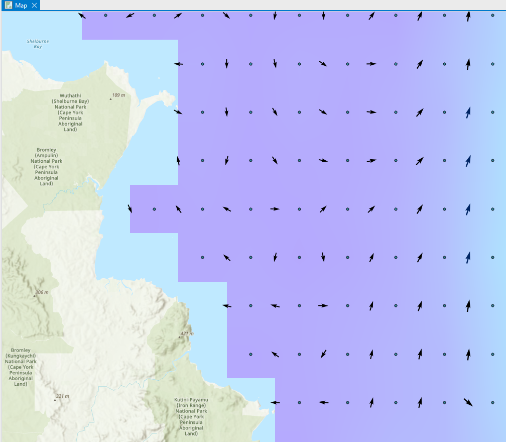
Hi all, I'm using ArcGIS Pro 3.0.2 to symbolize some climatology data which contains a magnitude and direction attribute. I am using the vector field to generate the symbology and am trying to understand how it is generated as I experience different results at different scales.
Questions:
1. How can I enforce placement of the direction arrow at the centroid of my raster? When I zoom in and out, the arrow placement appears to change to different locations around the raster cell.
2. Why do the arrows sometimes appear, but other times not?
3. Does the projection influence the symbology?
In the attached images, the vector points represent the centroid of my underlying raster. The 'Symbology 1.png' image is a smaller scale than 'Symbology 2.png' image. If you alternate between both images, notice the difference in placement of the vector field arrows. Why does this occur?
- Mark as New
- Bookmark
- Subscribe
- Mute
- Subscribe to RSS Feed
- Permalink
- Report Inappropriate Content
What does it do if you toggle on the U-V component checkbox?
(see way down in vector field in Change the symbology of imagery—ArcGIS Pro | Documentation )
... sort of retired...