- Home
- :
- All Communities
- :
- Products
- :
- ArcGIS Online
- :
- ArcGIS Online Questions
- :
- How can we retain vertical exaggeration in ArcGIS ...
- Subscribe to RSS Feed
- Mark Topic as New
- Mark Topic as Read
- Float this Topic for Current User
- Bookmark
- Subscribe
- Mute
- Printer Friendly Page
How can we retain vertical exaggeration in ArcGIS Online?
- Mark as New
- Bookmark
- Subscribe
- Mute
- Subscribe to RSS Feed
- Permalink
- Report Inappropriate Content
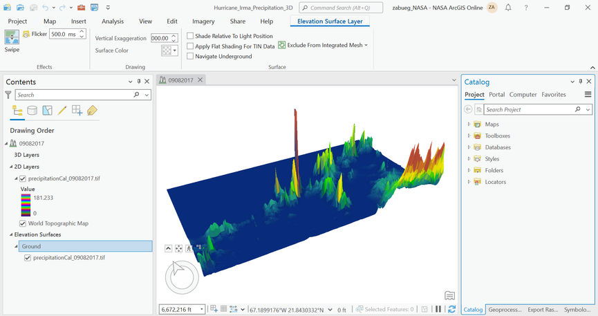
I have this local scene in ArcGIS Pro, where I've taken precipitation raster data, made it an elevation source, and vertically exaggerated the ground in order to show the data in 3D.
When I share this as a web scene to ArcGIS Online, the vertical exaggeration is not retained, which is a known limitation of ArcGIS Online (see here and here).
I've done research and seen people post about it here on Esri Community, but no one's posted an answer about how they successfully did it. My elevation unit was also already in feet (the smallest unit) so changing it to any of the other units wouldn't help.
Has anyone found a good workaround for retaining vertical exaggeration, or at least keeping its 3D effect, in ArcGIS Online?
Solved! Go to Solution.
Accepted Solutions
- Mark as New
- Bookmark
- Subscribe
- Mute
- Subscribe to RSS Feed
- Permalink
- Report Inappropriate Content
Would it be possible to use Raster Calculator to apply the "vertical exaggeration" to the raster itself? You would create a new raster to use as elevation surface and keep the original layer for visualization purpose. The new raster would be your old values multiplied with the vertical exaggeration you want to apply.
- Mark as New
- Bookmark
- Subscribe
- Mute
- Subscribe to RSS Feed
- Permalink
- Report Inappropriate Content
cross-posts come around.
The know limitations are as listed and your only option is to make an "Idea" on the ArcGIS Online community.
... sort of retired...
- Mark as New
- Bookmark
- Subscribe
- Mute
- Subscribe to RSS Feed
- Permalink
- Report Inappropriate Content
Would it be possible to use Raster Calculator to apply the "vertical exaggeration" to the raster itself? You would create a new raster to use as elevation surface and keep the original layer for visualization purpose. The new raster would be your old values multiplied with the vertical exaggeration you want to apply.
- Mark as New
- Bookmark
- Subscribe
- Mute
- Subscribe to RSS Feed
- Permalink
- Report Inappropriate Content
This is exactly what did it! Thank you Andreas, this is perfect.
- Mark as New
- Bookmark
- Subscribe
- Mute
- Subscribe to RSS Feed
- Permalink
- Report Inappropriate Content
@AndreasHall but this workaround isn't workable if you want to perform slope profile analysis or other types of spatial analysis in a web scene, as your profile graph will also show exaggerated values. unless it's possible to have multiple ground elevation layers in the scene, and toggle one or the other on or off in order to use the correct one in the profile tool?
David
..Maps with no limits..
- Mark as New
- Bookmark
- Subscribe
- Mute
- Subscribe to RSS Feed
- Permalink
- Report Inappropriate Content
This topic was about precipitation data so I do not think you would like to perform slope profile analysis on that kind of data? But you are right, web scenes only support ground, not custom elevation surfaces (Custom elevation surfaces are not supported in a web scene,) so to use both this kind of artificial vertical exaggeration and get correct height values when doing slope analysis in a web scene is not possible.
