- Home
- :
- All Communities
- :
- Products
- :
- 3D
- :
- 3D Questions
- :
- LAS Dataset to Raster causing stretching between a...
- Subscribe to RSS Feed
- Mark Topic as New
- Mark Topic as Read
- Float this Topic for Current User
- Bookmark
- Subscribe
- Mute
- Printer Friendly Page
LAS Dataset to Raster causing stretching between areas outside boundary
- Mark as New
- Bookmark
- Subscribe
- Mute
- Subscribe to RSS Feed
- Permalink
- Report Inappropriate Content
- Mark as New
- Bookmark
- Subscribe
- Mute
- Subscribe to RSS Feed
- Permalink
- Report Inappropriate Content
Chris,
This is a great question. It should probably be moved to the 3D space since Community Help is mainly for help with the GeoNet.
I am not sure how to pre-clip the raster output. I normally would just clip afterwards so I am curious to hear what others say. I normally go the route of LAS Dataset to a TIN network and from there I use the delineate TIN tool to get rid of the excess. However, I do not think that there is a similar tool for Rasters.
- Mark as New
- Bookmark
- Subscribe
- Mute
- Subscribe to RSS Feed
- Permalink
- Report Inappropriate Content
Thank you, I've moved it to 3D!
- Mark as New
- Bookmark
- Subscribe
- Mute
- Subscribe to RSS Feed
- Permalink
- Report Inappropriate Content
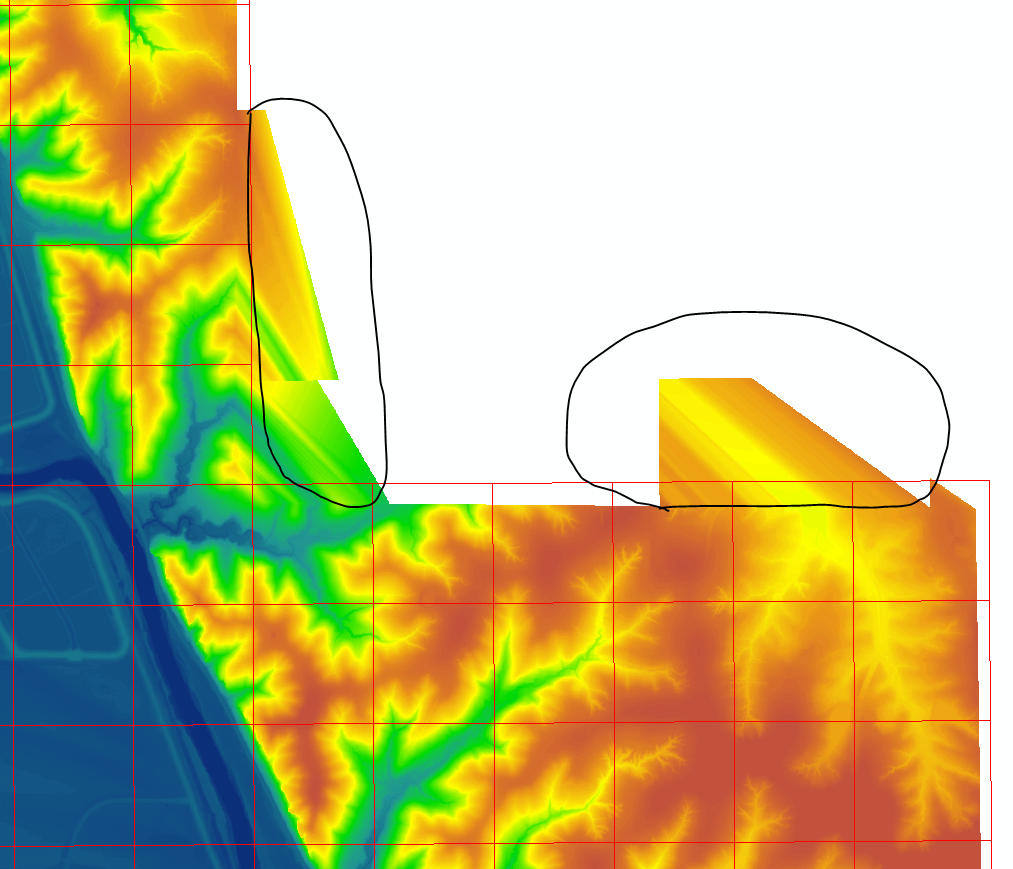
It may have something to do with the 'Void Fill' settings in the tool? If so, which setting would fix this?
Or maybe this from ESRI's LAS Dataset to Raster tool help: "Including a study area boundary as a clip constraint in the definition of the input LAS dataset is highly recommended. One reason is to prevent interpolation from occurring outside the real data extent of the survey." If it's this, how do I make a clip constraint in the LAS Dataset?
- Mark as New
- Bookmark
- Subscribe
- Mute
- Subscribe to RSS Feed
- Permalink
- Report Inappropriate Content
From here Tile LAS—Help | ArcGIS for Desktop it says to use
Note:
The Create Fishnet and Generate Tessellation can be used to create tiled polygons that cover the extent of the desired region.