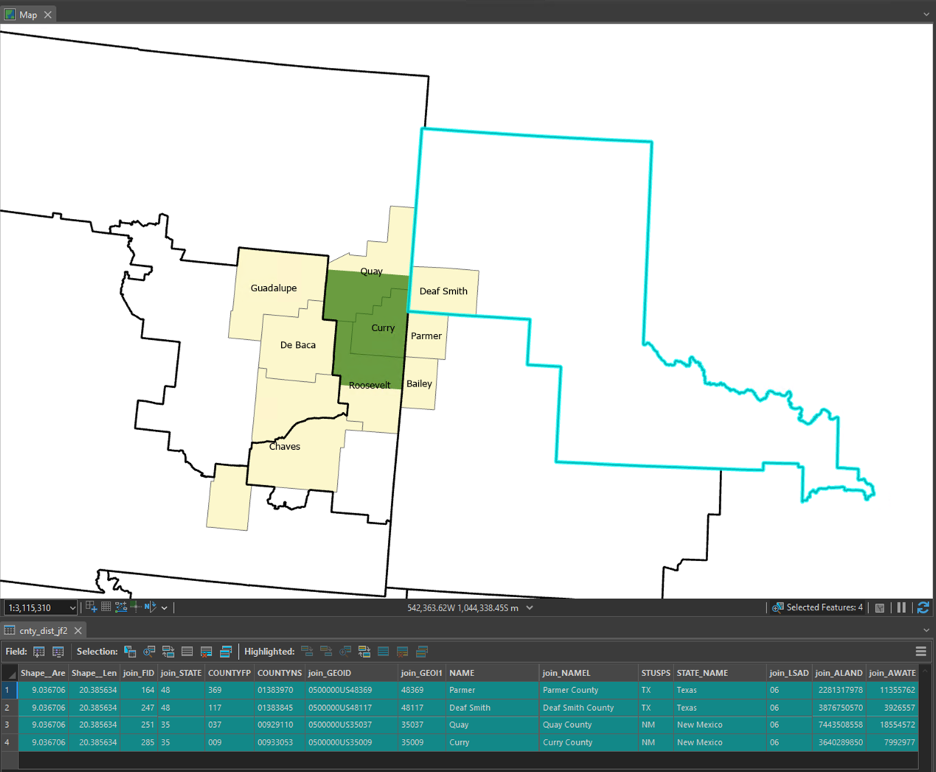
Using ArcGIS Pro 3.4, I'm trying to use Spatial Join to identify which counties are "within or partially within" a congressional district, but exclude those that merely touch a boundary. For example, Chaves county (yellow polygon) should be in multiple districts (black boundary lines), while Deaf Smith should be in only one district.
Using "largest overlap" doesn't work because it only returns the single largest overlap and "intersect" doesn't work because shared boundaries create many incorrect duplicates.
SHPs available here - https://www.census.gov/geographies/mapping-files/time-series/geo/cartographic-boundary.html
Join Features is supposed to accomplish this using "Overlap" but is still returning polygons with shared boundaries. (The bottom image is directly from this link and shows that shared boundaries should NOT be included.)


This is the result of Join Features using "Overlaps" and one-to-many, four counties returned rather than just the one: