Project Origin and Objective
In 2023, a group of students at the University of North Texas (UNT), a public research university in the Dallas-Fort Worth metroplex, set out to collect information about their campus forest. The project originated from the need for an updated campus tree inventory and faculty and student interest in preserving the Post Oak tree population. Our goal was to use GIS to locate and collect data for each tree on campus to create the needed dataset to better preserve, manage, and grow our urban forest. Little did we know that this project, powered by geospatial technology, would ignite a new generation of environmental stewards, fight for the protection of a legacy oak in danger of removal, and engage the community in our urban forest.
Local Environmental Context
Urban development has decimated the natural landscape of prairies and mixed forests in the Dallas-Fort Worth metroplex. The receding habitat patches among the urban sprawl serve as a network of green islands supporting local ecosystems. These habitats are also essential for supporting global migratory species along North America's Central Flyway (Source).
Post Oak is the dominant tree species on UNT’s main campus — providing shade, habitat for wildlife, and contributing to the university’s sense of place. Due to their sensitive root systems, Post Oaks are difficult to grow commercially, generally only established naturally, and are often considered irreplaceable in the landscape (Source). UNT’s Post Oak trees are in danger of limb loss/death from large storms, freezes, drought, development, and minimal recruitment due to only a handful of protected saplings. These trees are part of a dwindling remnant forest that likely existed well before the University was established in 1890.
 Aerial photos from 1946 compared to 2023 visualize the deforestation and development of the northwest corner of the University of North Texas. Green letter markers orient the comparison.
We conducted a manual tree inventory to understand how to best preserve these trees and grow the urban forest at UNT. Using GIS tools, our student group created a database of around 3,000 trees. This collection of information on the forest’s spatial distribution, species composition, size, and condition can inform tree management and an updated tree preservation policy.
GIS in the Hands of Students
The accessibility of Esri tools, such as ArcGIS Field Maps, enabled our student team to collect high-quality data efficiently. ArcGIS Online was essential for managing data collection between multiple teammates and collaborating on data analysis. Additionally, the height data was collected to ground truth a LiDAR scan for a UNT PhD student's research. Most importantly, the data collected using Esri tools empowered students to protect their environment by engaging decision-makers.
Our Process
We developed an effective workflow after reviewing existing manual tree inventory methods online and through trial and error.
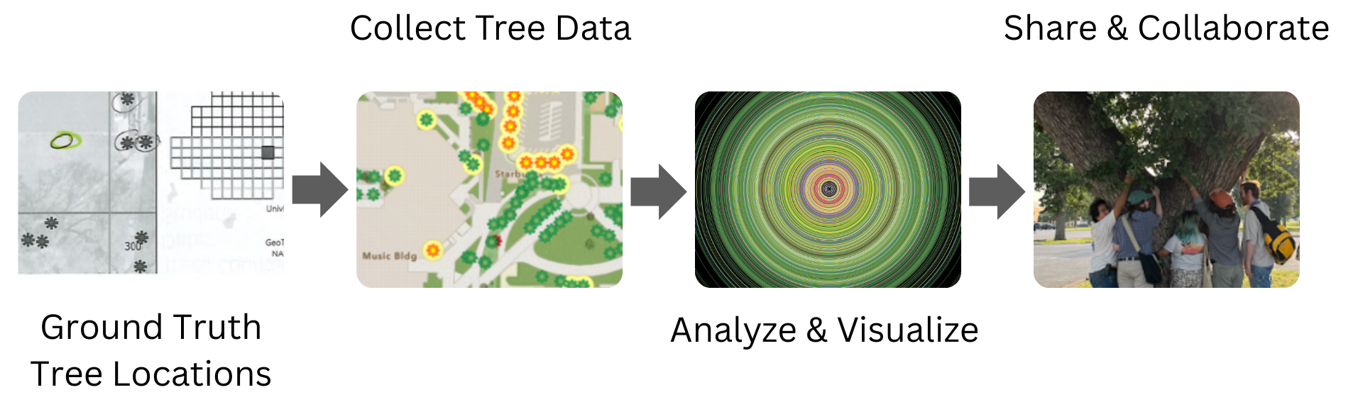
After we used an ArcGIS Pro map series to ground truth tree locations, ArcGIS Field Maps allowed our small team to divide and collect data simultaneously. Using Arcade expressions to symbolize the tree feature layer based on what data had been collected, we could glance at the map and track what was completed.
 Example of web map symbology in ArcGIS Online used for data collection via Field Maps
While similar applications of Esri tools exist, the commitment to collaboration and public outreach propelled our work beyond our imagination. Creative data visualization enhanced our ability to tell the story of UNT’s trees by successfully engaging project stakeholders, university deans, students, and science conference audiences across Texas.
 Visual representation of the relative DBH (diameter at breast height) (rings), height (bars), and spatial distribution of individual trees in UNT’s urban forest. The diameter and height visualizations are colored based on tree genera (Oak, Elm, Pecan, etc.) and provide a story about the physical characteristics of individual trees within both the population and community.
Project Sustainability & Reach
Students created the Mean Green Tree Team to raise awareness of the structure, composition, condition, and value of UNT’s urban forest. The tree team collaborates with ground management leaders to discuss data maintenance over time and to work together on revising campus tree policy to better protect large, healthy, old-growth trees.
Since 2023, this initiative has provided 24 UNT students with experience in data collection using geospatial technology, urban forestry, proposal writing, and presentation opportunities. Additionally, student leaders have crafted an accessible methodology that can empower students at other universities to implement similar projects. The Mean Green Tree Team trains paid undergraduate interns to apply this approach to local DFW municipalities for urban applications.
Additionally, members of the team have given more than fifteen presentations about UNT’s urban forest to project stakeholders, community members, and university leaders, as well as at arboriculture and ecological conferences.
The Case of Stella
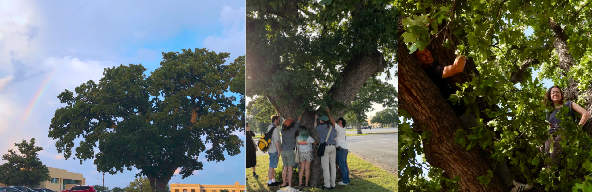
Toward the end of the initial inventory, we learned about the science research building planned for construction in the parking lot where the largest Post Oak tree on campus existed. Unfortunately, despite the best efforts of UNT students and staff, the healthy 200- to 250-year-old Post Oak was cut down. Without the data collected from the 2023 tree inventory and subsequent presentations, the UNT community may have remained unaware of the significance of this tree.
Although this was unfortunate and avoidable, we were amazed by the number of people brought together by this event. Multiple farewell events were scheduled, including ceremonies from the UNT Native American Student Association and the Indigenous Institute of the Americas.
This is an example of the potential of geospatial technology to engage communities and empower the fight for the conservation and preservation of the natural world. We hope this example will shed light on the importance of tree preservation at the University of North Texas and at universities and other landscapes across Texas. We must rise to our potential to build and interact with the world in more creative and respectful ways.
Project Conclusions
The original student-led tree inventory was only the beginning. This evolving initiative has sparked new generations of students to engage with GIS and their local environment. This project highlights how geospatial information can be harnessed to tell a story that effectively communicates the importance conserving and preserving the natural world. Especially in urban environments where nature is not often prioritized.
Websites/Links
UNT Tree Inventory https://cdn.arcgis.com/home/item.html?id=e6879e5bb20e41468fbf82dd8d1fc02b
UNT Mean Green Tree Team Social https://www.instagram.com/meangreentreeteam/
Dashboard Video https://savannah-thomas.com/campus-tree-inventory/
In Symbiosis Art Exhibit https://savannah-thomas.com/in-symbiosis/
Tree Inventory YouTube Tutorials https://savannah-thomas.com/gis-tutorials/
