When the University of Denver (DU) first reached out, the situation sounded familiar. They had a commercial space management platform that had served them for years, but it was no longer scalable. Facilities data, space records, and GIS lived in separate places. Reporting meant chasing down exports and manually cleaning spreadsheets. Changes happened informally, with no audit trail and no clear ownership over who was supposed to update what.
They wanted something better. What we ended up building was something they hadn’t originally imagined.
The Problem Worth Understanding
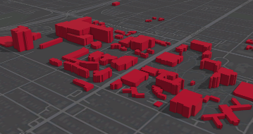
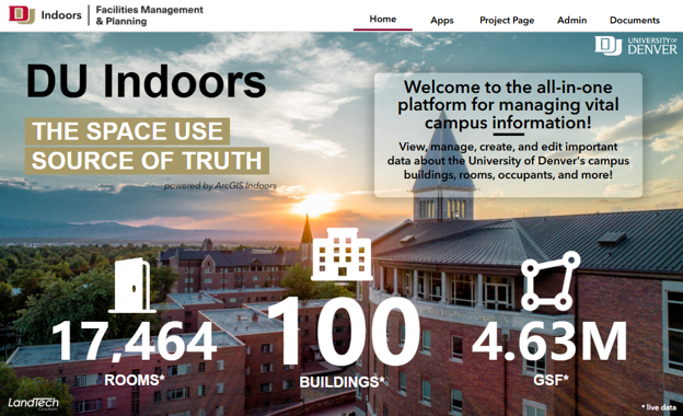
DU manages over 100 buildings with more than 4.6 million total square feet across its main and satellite campuses. That's a lot of space to keep track of, and a lot of stakeholders with competing reporting needs: Space Management, Budget and Business Officers, Building Managers, Grant Administrators, Facilities, Campus Safety, IT, and campus leadership.
The old platform wasn’t broken in an obvious way — it just didn’t reflect how a research university actually runs. DU needed to track not only who was sitting where, but also how space is tied to grants, how it is being used, and indirect cost recovery. That’s a reporting obligation with real financial consequences, and it was being handled through manual processes that depended on individual people knowing the right things.
Meanwhile, the GIS team was fielding a steady stream of one-off requests that should have been self-service. Every report, every export, every “can you just pull this for me” was time the team wasn’t spending on anything else. That’s a systems problem, not a staffing problem.
Starting Small, Scaling Smart
Rather than jumping straight into a campus-wide overhaul, DU and LandTech started with a pilot involving four buildings. This wasn't just a proof of concept — it was a structured opportunity to validate that ArcGIS Indoors could handle DU's needs, surface the right configurations, and give stakeholders something concrete to react to before committing to a full rollout.
The pilot worked. And the lessons it generated shaped everything that followed.
One of the most important steps during that phase was to invest heavily in building validation. DU's project team walked and re-walked buildings, verified floor plans, and confirmed attribute data before importing even a single record. That upfront effort paid off throughout the project — accurate data on import means faster QA/QC, fewer surprises, and better adoption from day one.
More Than a Tool Swap
The easy path would have been to map the old platform’s features onto ArcGIS Indoors and call it done. We pushed back on that from the beginning.
ArcGIS Indoors is capable of a lot more than one-to-one replacement — but to get there the foundation should be right. That meant three things had to be true: the data needed to be clean and maintainable, the workflows needed to be built for the people actually doing the work (not just the people reading the outputs), and the GIS team shouldn’t end up in the same situation a year from now — buried in manual requests.
We also extended the standard Indoors data model with an enhanced schema to capture what DU specifically needed: grant space allocations and indirect cost recovery tracking. Getting that schema right before building any applications saved a significant amount of rework later. That’s the kind of thing that’s tempting to defer, and that you always regret deferring.
Getting the Data Right First
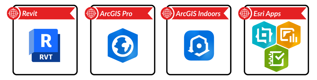
Legacy Revit floor plans were reviewed, standardized, and imported into the ArcGIS Indoors information model. Attribute data — department, room type, grant assignments — was normalized and loaded from a separate system for consistent reporting. The data model back-and-forth with space management and finance teams wasn't just about getting the right fields. It was about agreeing on the right vocabulary and the right relationships between things.
Instead of jumping straight into building the apps, it’s crucial that the data model is accurate as all apps are built on top of it.
Six Applications, Each with a Job to Do
Once the data was in good shape, we built out a suite of six applications — each one scoped to a specific audience, rather than trying to serve everyone from a single interface.
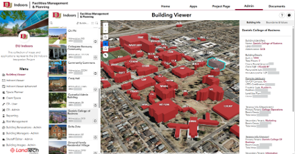
Building Viewer gives operations and planning teams building-level information in a 3D scene, with details on square footage, renovation history, ERM values, and FICM data.
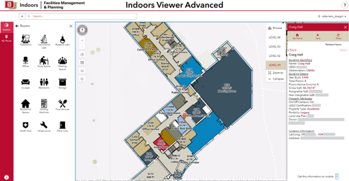
Indoors Viewer, an out-of-the-box template application, gives broad campus users a clean, intuitive way to navigate buildings and find rooms — the single source of truth for interior space data that DU had been missing.
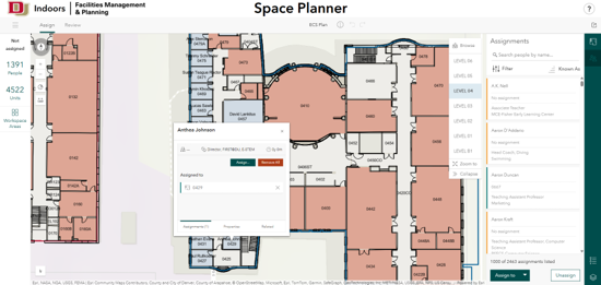
Space Planner, an out-of-the-box template application, provides space managers with a purpose-built interface for allocations, assignments, and occupancy planning. It's now become one of the most popular tools on campus — a consistent solution for one of the most common daily challenges.
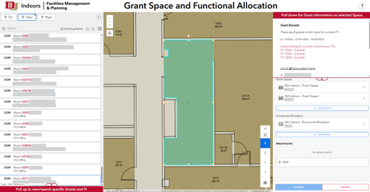
Grant Space and Functional Allocation is built for research administration. Staff can select a unit, enter a Grant ID, and have all related grant information auto-populate from Banner, the university's enterprise system for student, financial, and administrative data. Functional allocations are tracked annually per room, with Arcade-powered data integrity checks to help identify issues early. Making this process genuinely simple for end users was critical — and ArcGIS delivered.
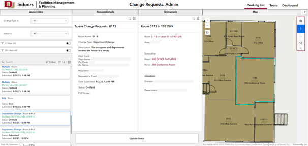
The Change Request Suite is where DU's governance model really comes to life. It includes three applications: Change Request Single for room-by-room submissions, Change Request Bulk for business officers managing large numbers of spaces via spreadsheet upload, and My Change Requests Dashboard so an user can track their own submissions. Approved requests are processed nightly into the Indoors data model automatically.
That last one matters more than it sounds. Most indoor GIS implementations give people a way to view data. Fewer have a formal, traceable process for changing it.
Automation That Actually Freed Up Time
One of the most concrete wins for DU’s GIS team was getting hours back every week. We built a series of ArcGIS Notebooks to handle the reporting work that had previously been done manually. These Notebooks pull units and occupants data, match records, and produce formatted Excel workbooks that are then ready to distribute. Space inventories, occupancy by department, building reports — all of them run on demand instead of being assembled by hand.
Automated QA/QC validation is also baked into the process, so data quality issues get caught before they appear in a report at an inconvenient moment.
Governance Is a Deliverable
Here’s the thing about indoor GIS projects: the technology is usually the easier part. What determines whether a system actually gets maintained and used is whether there’s real structure around it — and that doesn’t happen by accident.
For DU, we scoped governance as a formal deliverable. That meant documented procedures for every major workflow, written for the staff who are primarily responsible for carrying them out. Data maintenance and editing guides that don’t rely on someone’s institutional memory. A change management process with validation checkpoints and a clear audit trail. Admin tools for user management and configuration — including tools for building renovations, building manager contacts, utility shutoffs, and building imagery.
None of that is glamorous. None of it shows up in a demo. But it’s core to any implementation, and is the difference between a successful launch and a system that quietly falls apart over the following years.
Where Things Stand Now
Once DU staff could actually see their space data — accurate, in one place, updated and trustworthy — the questions changed. Instead of “can you pull a report on building X,” people started asking “could we track this?” and “could we automate that?” The platform started generating its own momentum.
What started as a replacement for one commercial tool is now a mission-critical enterprise system. Multiple integrated ArcGIS solutions are running as one, and DU has a foundation in place for what comes next — two-way integration, deep linking work orders, and AI assistance as technology matures.
Lessons for Building an Indoor GIS That Lasts
Start with a pilot. A proof-of-concept surfaces the right configurations, builds stakeholder buy-in, and sets up the full rollout for success.
Get the data model right. If you skip extending the schema in week two, it can become expensive problems in month six.
Build for the operators, not just the end users. The people editing and maintaining the data matter just as much as the people reading dashboards — design for both groups from the start.
Scope governance as a deliverable. Requests, documentation, validation — if it’s not in the project scope, it doesn’t get done.
Invest in automation. Time put into automation such as scripted workflows pays back every time a task doesn’t require someone to do it manually.
Treat Indoors GIS as a system, powered by ArcGIS Indoors. The ceiling on what it can support is higher than most people expect when they first come to it.
Want to See More?
We put together a full StoryMap walking through the DU Indoors implementation — from pilot to campus-wide deployment, including the full application suite and what's coming next:
Reimagining Space Management at DU with ArcGIS Indoors
About the Author and LandTech Consultants
LandTech Consultants is an Indoor GIS Specialty partner focused on 3D GIS, digital twin development, and custom ArcGIS Indoors implementations. As a survey and engineering firm, LandTech can support all aspects of Smart Campus operations — from laser scanning and modeling to utility mapping to enterprise indoor GIS.
Katie Iles is LandTech's GIS Manager and has spent years working at the intersection of indoor mapping, facility operations, and the ArcGIS platform. She's seen ArcGIS Indoors deployed across schools, universities, airports, and everything in between — and what keeps it interesting is that every organization brings a different problem. The platform is flexible enough to meet them where they are. Katie's job is figuring out what that looks like in practice.
To learn more, reach out at www.landtechinc.com/contact-us/ or call 978-692-6100.
