Good day, everyone.
We are configuring a Water and Sewer Utility Network for a Brazilian customer with the following requirements:
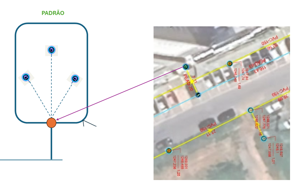
- Representing multiple geographically represented service meters connected to a single service line (standard in this region).
- Selecting these service meters during a trace for further analysis.
Has anyone else modeled this scenario in a Utility Network? We would appreciate any best practices you can share.
Conceptually, the visual model includes a connection point or device (indicated by the orange point) at the service line termination, serving as the attachment for multiple geographically represented service meters.
Thanks for any input!



