Hi I am looking to use the Calculations on Geopoints method to map my Survey123 output data on a world map.
For this I need geopoints data of all countries (or specifically, geopoints of the capital cities to make it consistent) in a format shown in this example.
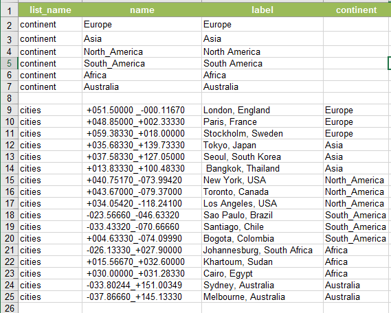
Does ArcGIS have a excel table of all countries and the corresponding geopoint data available for download? I'm planning to use this data with the ArcGIS World Countries Generalised Shapefile layer , so looking for something created by ArcGIS for good compatibility.
Any help would be hugely appreciated!

