A simple Map Algebra operation in the Raster Calculator using a GeoTiff as input and adding a constant to it should result in a new raster having the identical footprint and resolution, with only the pixel values changed by the operation.
For example:
"mydem.tif" + 34.169998
However, when this is done, whether the output is allowed to go to a temporary raster and then made permanent by using Data>Export Data and specifying TIFF format, or the Raster Calculator is explicitly set to output a tiff initially, the tfw "worldfile" created conflicts with the internal georeferencing information in the geotiff header.
The X,Y pixel size in the header and the X,Y corner coordinates of the tfw are both altered slightly.
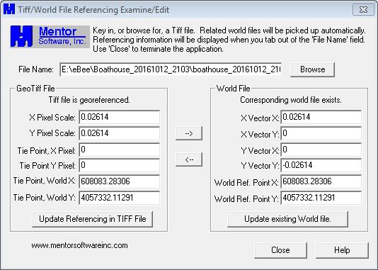
Here is the GeoTiff header and ftw file information of an input file, with matching information:
And here is the information from the resulting output tiff file after the Raster Calculator operation:
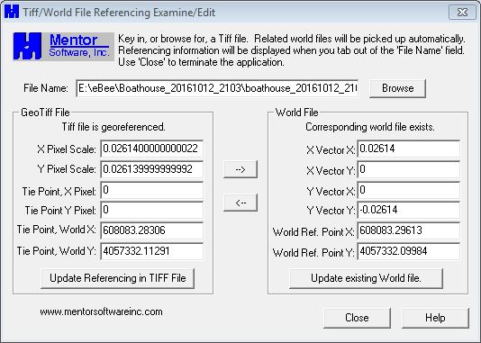
The cell size in the header has changed by a very small amount, and the tfw corner coordinate has changed by 0.01307, or 1/2 pixel.
Anybody know why the output Tiff/Worldfile referencing is not identical to that of the input, as one would expect it should be?

