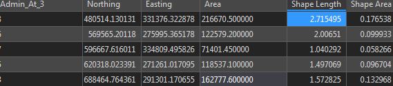
The Co-ordinate system of the map is in WGS1984 I've attribute table attached with different shape length and area as well as area. So, can it be possible to change it into Square Kilometers? Is there any geoprocessing tools for this Question?
arcgis pro 2.0.1 #geoprocessing_tools
#attribute tables


