Hi,
I would like to symbolise a hosted point feature layer based on data from 2 different fields using the Smart Editor Widget.
A record is initially entered as a Reported Risk Priority of 1 or 2. This symbolises as Red or Amber on the web map. The record is then updated via a separate field and is assigned the Response Risk Priority of 1, 2 or Closed. The idea is that the colour coded symbols on the map displays Reported Risk as Red or Amber until Response Risk is assigned at which point it may change or remain the same colour.
Using ArcGIS Pro I symbolised every variation I can think of and the Smart Editor Widget looks like below.
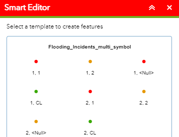
However I only want to include 1, Null and 2, Null as the web mapping application is used at the point of adding the initial record and allocating the Reported Risk Priority.
Other than having lots of separate layers I cannot think of another way to do this. I hope I have managed to explain my problem?
Thanks



