No Update Required
If you already have the 2026.1.0.0 version of ArcGIS for SharePoint installed from the SharePoint Store or Microsoft Store, there’s no need to install a new version of the app.
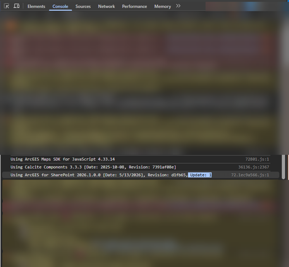
Simply reload or refresh your browser, and the latest enhancements will automatically become available in your existing ArcGIS for SharePoint experience. To verify you are running the latest version, open your browser's Developer Tools, navigate to the Console tab, and compare your screen to the example below to ensure the ArcGIS for SharePoint version matches exactly.
Richer maps with label classes
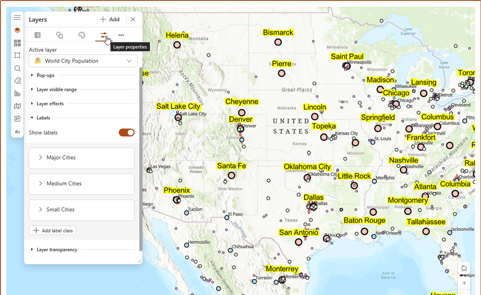
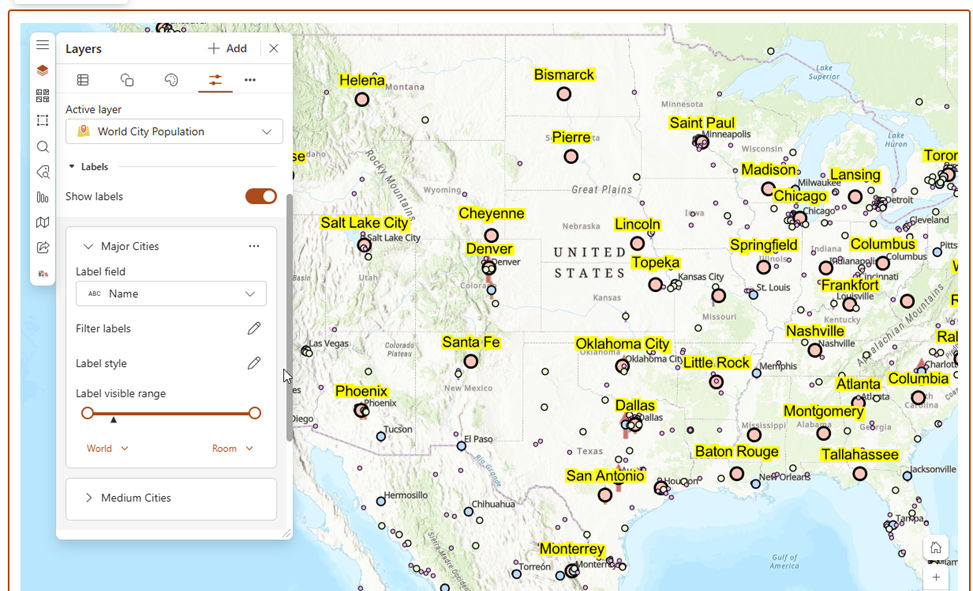
You can now configure label classes in ArcGIS for SharePoint, bringing labeling capabilities closer to the experience available in ArcGIS Map Viewer.
With label classes, users can:
- Apply multiple labeling rules to a single layer
- Customize label styles and placement
- Control visibility based on scale ranges
- Improve readability for complex datasets
- Highlight important features using different labeling logic
This enhancement makes it easier to build polished, informative maps directly inside SharePoint without needing to switch applications.
Why it matters
Organizations often work with datasets that require different labeling behavior depending on context. For example:
- Cities can display different labels based on population size
- Utility assets can use separate labels for status or type
By supporting label classes, ArcGIS for SharePoint now provides a more flexible and consistent cartographic experience across the ArcGIS ecosystem.
Dynamic Time Slider for SharePoint Data
This release also introduces a Dynamic Time Slider enhancement for SharePoint lists and document libraries.
With this update, the time slider can now automatically adjust its available time range as new data is added to a SharePoint list or document library. This allows maps to stay current without requiring users to manually reconfigure time settings.
In addition, ArcGIS for SharePoint now includes several time slider capabilities leveraged from ArcGIS Map Viewer to provide a more interactive and configurable temporal visualization experience.
What’s new
Users can now:
- Dynamically update the time slider range based on incoming SharePoint data
- Visualize newly added time-enabled records automatically
- Reduce manual maintenance for time-enabled layers
- Dynamically update the time slider range based on incoming SharePoint data
- Visualize newly added time-enabled records automatically
- Configure animation mode for time playback
- Adjust time intervals for temporal visualization
- Control animation speed for smoother playback experiences
This is especially useful for scenarios involving continuously updated datasets such as:
- Field observations
- Incident reporting
- Drone images with EXIF metadata uploaded to a SharePoint
Important note
To ensure the latest records appear on the map and are reflected in the updated time slider range, make sure Layer Refresh is enabled for the SharePoint layer. This allows the map to periodically refresh and display newly added features from the SharePoint list or document library.
Bringing More ArcGIS Capabilities into SharePoint
These updates continue our goal of bringing powerful ArcGIS capabilities into familiar Microsoft workflows. By improving map labeling and enabling dynamic time-aware visualizations, ArcGIS for SharePoint helps teams create clearer maps and work more effectively with live SharePoint data.
Stay tuned for more enhancements in upcoming releases.
