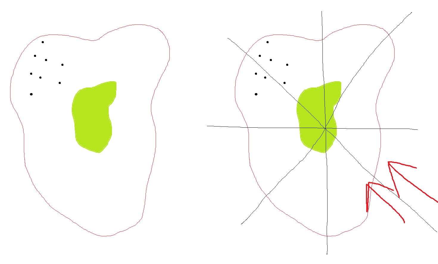
Is there a way to split polygons by cardinal directions?
We have multiple polygons for prescribed fires. Within these polygons we have identified all the structures. Based on the location of the buildings we cannot burn during the opposite wind.
In the images below: the left image show what we have, the green field that will be burned, the red buffer, and the black buildings. We would like to create a map showing something similar to the image on the right where the buffer is split by direction and then because the buildings are in the NW part of the buffer, we cannot burn during a SE wind.
Is there a way to do this quickly? We have many fields that this process would need to be done to.