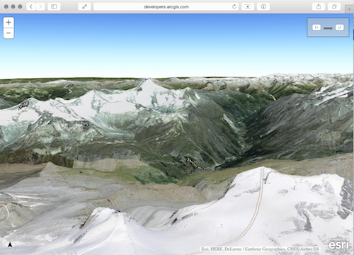
Yesterday, the new version 3.14 of the JavaScript API was released. Today followed the first beta for the JavaScript API 4.0.<\/SPAN><\/P><\/P>ArcGIS API for JavaScript 3.14<\/SPAN><\/H3><\/P>Fundamental innovations are 2 new interfaces or workflows that are now supported:<\/SPAN><\/P>Extensions for Operations Dashboard<\/SPAN><\/LI><\/UL>Until now, these were only possible for the Windows version of the Dashboard with ArcGIS Runtime SDK for WPF. Now widgets, map tools and feature actions can also be programmed using the JavaScript API. And these extensions can be used in both versions of the Dashboard (Windows and Browser). https:\/\/developers.arcgis.com\/javascript\/jshelp\/operations-dashboard-extensibility-overview.html<\/A><\/SPAN><\/P>Connection to DataReviewer<\/SPAN><\/LI><\/UL>A series of tasks to integrate ArcGIS Data Reviewer for Server functions into a web application. https:\/\/developers.arcgis.com\/javascript\/jshelp\/intro_datareviewer.html<\/A> <\/SPAN><\/P><\/P>In addition, there are also some functional adjustments:<\/SPAN><\/P>Adjustments and extensions of Smart Mapping functions (including a new renderer called BlendRenderer)<\/SPAN><\/LI>2 new widgets, but still in beta: Elevation Profile and Layer List (Absolutely revolutionary and never requested before, a TOC in the JavaScript API)<\/SPAN><\/LI>Support for WFS and adjustments in support for Image Server<\/SPAN><\/LI><\/UL><\/P>All changes can be found as always at the following link https:\/\/developers.arcgis.com\/javascript\/jshelp\/whats_new.html<\/A> <\/SPAN><\/P><\/P><\/P>
<\/P>
In addition, there are also some functional adjustments:<\/SPAN><\/P>Adjustments and extensions of Smart Mapping functions (including a new renderer called BlendRenderer)<\/SPAN><\/LI>2 new widgets, but still in beta: Elevation Profile and Layer List (Absolutely revolutionary and never requested before, a TOC in the JavaScript API)<\/SPAN><\/LI>Support for WFS and adjustments in support for Image Server<\/SPAN><\/LI><\/UL><\/P>All changes can be found as always at the following link
Signed in members can post, follow updates, and more. New here? Register a free account.
Find useful guides, FAQs, and documents to help you navigate and make the most of Esri Community.