HARRIS and Esri have taken the integration of their applications beyond interoperable solutions. ENVII provides ArcGIS with advanced image analysis capabilities that are fully integrated.
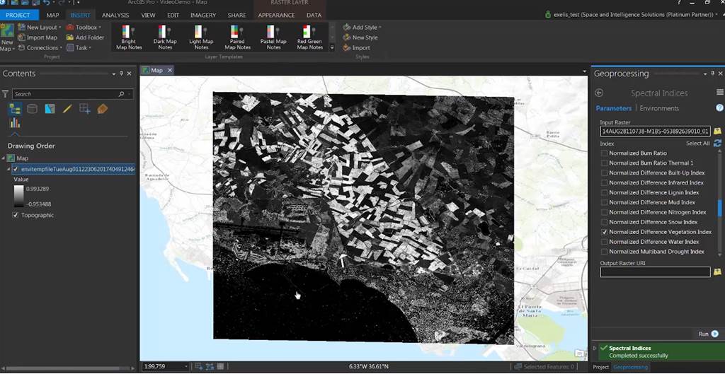
A recent innovation of ENVI is the “ENVI Modeler”, a new visual programming and custom workflow modeling tool based on Task. It combines the power of the ENVI application programming interface (API) with a simpler and more intuitive user interface, allowing you to create workflows without any knowledge of the ENVI programming language (IDL). The custom data processing that combines multiple Tasks can be published as a standalone tool in ArcMap or ArcGIS Pro.
"ENVI Py for ArcGIS" is another innovation that offers a simple and powerful tool to run ENVI analytics in ArcGIS Pro and ArcMap. An ENVI Analytics toolbox is automatically added to ArcGIS Pro or ArcMap. You can also create as many custom ENVI toolboxes as needed, thanks to the ENVITask functions.
Regarding Interoperability and Integration of ENVI and ArcGIS, we have the following:
At the data level in ENVI:
- Direct Reading / Writing / Creation of ArcGIS Geodatabases.
- ArcGIS map projection engine.
- Esri layer support.
- Direct access to Esri base maps.
- Import of ArcGIS map designs.
- Support for Standards such as ArcGIS for Server, Image Services, ArcGIS , OGC, REST.
At the data level in ArcGIS:
- Reading / Writing ENVI files from platforms such as Desktop, Server or Mobile.
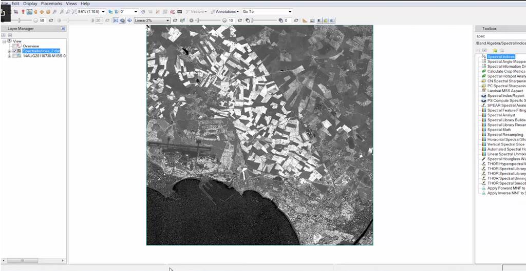
- Direct opening of ENVI files to ArcMap and ArcGIS Pro.
- Incorporation of ENVI files into Esri layers such as Mosaics, Layers, and Image Services.
At the interface level:
Users can send data in ArcGIS with a single mouse click, and they can drag and drop data from ArcGIS directly into ENVI.It is possible to link both interfaces at the same time, providing a smoother experience
At the tools level:
ENVI Tools: Now users can use ENVI and ArcGIS tools in one toolbox to easily process image data, terrain, vectors, and raster, all in a single interface.
This provides ENVI functionalities on the ArcGIS platform, and users can perform advanced image analysis from the ArcGIS interface, where you will achieve:
- Run advanced image analysis tools, mainly the most popular ones directly from the ArcGIS interface.
- Create custom ENVI algorithms for consumption in the ArcToolbox.
- After installing ENVI, processing tools will automatically appear in ArcGIS.
IDL-Python Bridge: It is a Bi-directional bridge that allows easy calling of Python from IDL or running IDL from Python between both platforms.
GSFpy: (Geospatial Service Framework Python) allows integrating ENVI analysis tools into the Toolbox of ArcMap or ArcGIS Pro so that any task or tool used in ENVI can be available in ArcMap or ArcGIS Pro by creating a tool.
At the Workflow level:
ArcGIS Model Builder allows batch processing
- Drag and drop ENVI tools into your models.
- Build custom workflows integrating tools from both platforms.
- Reduce time to execute workflows that have many steps.
Scripts for geoprocessing of ENVI and ArcGIS offer greater customization.
- Automate extremely complex processing functions.
Combine advanced image and vector analysis into powerful tools for your users.
Were you present at the recent Webinar on ENVI and ArcGIS Integration? Tell us what caught your attention the most. If you were unable to attend, you can find the video (webinar link) on our YouTube channel.
