Hi all,
I have a query about using the elevation profile tool in ArcGIS Earth v1.8/v1.9. When i create a profile between the same two points, it appears the average percent slope differs from going low to high and high to low (see below).
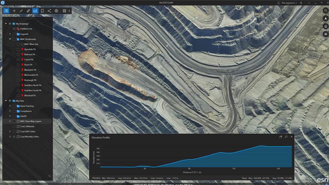
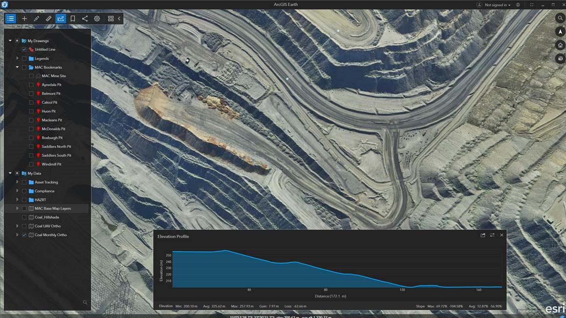
Results are:
Low to High – average slope: 49.98% -17.15%
High to Low – average slope: 12.87% -56.9%
We are using our own elevation service to calculate the elevation profile. I'm sure there is a simple answer for this but i cannot think of one off hand. Any assistance would be most welcome.
Thanks,
Andrew

