We're working with a mix of different software to store and query our data on our PostgreSQL Server. We've found a way to deal with geometry data and convert the default st_geometry datatype into postGIS "geometry" and thus can query the data from inside R, for example, without external tools.
When storing our raster data on the server, this task becomes much more difficult. Viewed in pg admin, my raster dataset consists of a table with a single row of the following columns: oid (integer), footprint (st_geometry), raster (integer).
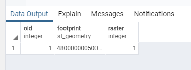
Where is the raster file (BLOB?) stored? We've searched through our database, but couldn't find anything relevant. Maybe these dependents give a hint?


