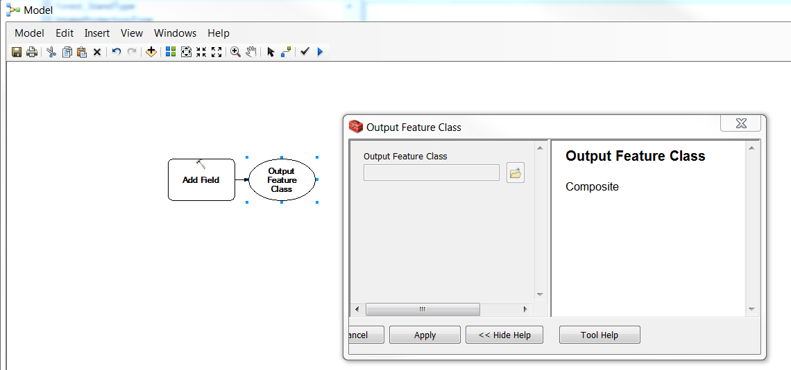
I am creating a pretty conventional ModelBuilder using file geodatabase feature classes to run proximity checks, spatial joins, attribute joins, etc. I make these quite often with no issues. For some reason my Model Builder has magically changed to use the "Composite" data type as my outputs. I have no idea why this would be since I only use file geodatabase feature classes copied to a scratch geodatabase. I am using a Toolbox.tbx on my C:\ disk with ArcGIS 10.4.1. The issue appears to replicate in other models. See a screenshot as an example. I would greatly appreciate any assistance on this issue because I seem unable to change the output data type and I'm paralyzed until I can string together the geoprocessing (I can run a manual iteration in the mean time but need to deliver the model to a client).