Hi,
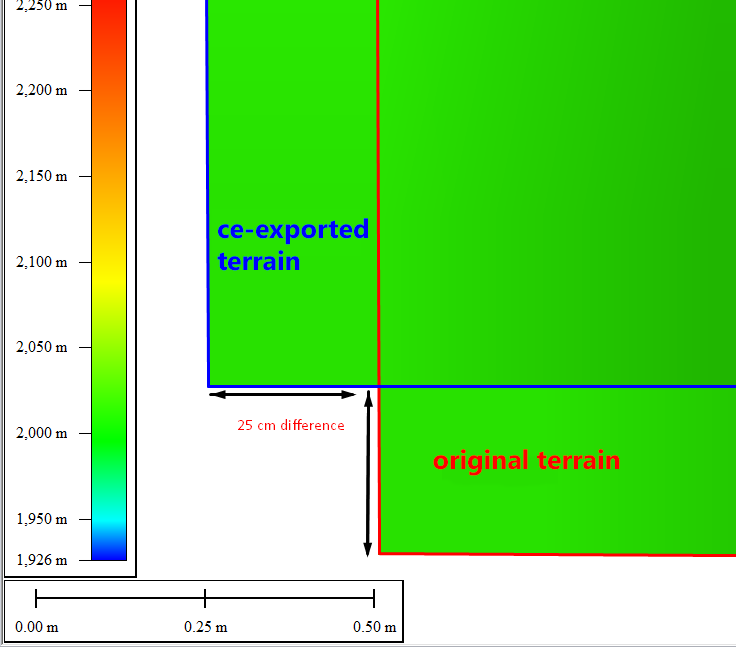
I'm having problem exporting terrain elevation as an image/heightmap (tif 32bit) - the exported image from cityengine is shifted by approx 25cm to the left and to the top compared to the original heightmap as shown on the picture below (screenshot from globalmapper)
How to reproduce:
Let's say I have:
- a 32bit tif (geotiff) crop of 1x1km terrain (heighmap)
- in WGS84 UTM 32N
- with nicely rounded bounds: (300 000,5 000 000 - 301 000,5 001 000)
- with 0.5m sample spacing (so that its resolution is 2000px x 2000px)
I import this tif into cityengine an coordinates looks correct:
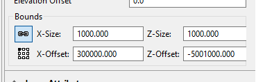
(original terrain properties)
then I changed terrain resolution from 1024x1024 to 2000x2000px and exported this terrain from CE to 32bit tif and load it alongside the original terrain an I get this difference (as shown on the first image)
to double-check this problem, I also loaded the newly-exported terrain into cityengine and I can confirm that this terrain has different coordinates then the orignal one
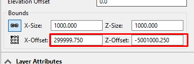
(ce-exported terrain properties)
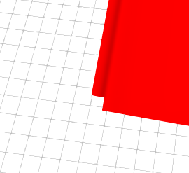
I can also visually confirm in CE that the original and exported terran don't match:
Am I doing something wrong? or can anybody confirm that this is a bug?
I checked the following things and none of them has an effect on this bug - the result is still exactly the same: shifted by 25cm:
- changing terrain resolution
- changing bit depth of tif during export
- terrain smooth/none toggle
- exporting non edited/edited terrain
- exporting edited/non edited terrain with elevation delta file
for somebody it might look as if 25cm is not a big deal but for my workflow it is: I'm using tiled terrain in very-detailed city and I get a gap between the terrain boundaries and I need to export terrain from CE correctly because I'm doing heightmap adjustments to it
I'm attaching the original and the exported terrain so that you can try to replicate this bug
any help appreciated
thanks,
Mark

