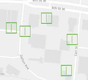
I am having a problem with the symbology in multiple layers not showing up properly in Runtime. It's in a replica geodatabase and then brought into the app. The symbols look correct in ArcMap (10.6.1), in the map service (server 10.4), but not in the Runtime app. What's causing this and how can I resolve it?
This is one example: symbol with two layers, a square and a line offset to make one side look thicker.
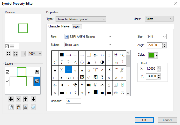
In the app, that line is losing its offset values and showing up at the center of the symbol.