So I have a feeling the simplest way to solve my problem may just be for me to manually go over the data but here it goes.
I need to select all the of parcels that have more than 1 land use zone. So for example, I have a parcel polygon that is intersected by 2 zone polygons and I have a lot of them. I need to create a layer to show only those parcels that have multiple zones. Is it even possible to automate this even if it requires some manual clean up afterwords?
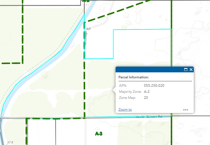
In the image above shows the selected parcel is in 2 different zones. I have an Arcade expression to show the zone with the highest percentage covering the parcel but now I need to actually select and create a new map showing all the parcels like this.
Any help or advice would be greatly appreciated.
Thank you,
Derek



