Hi guys,
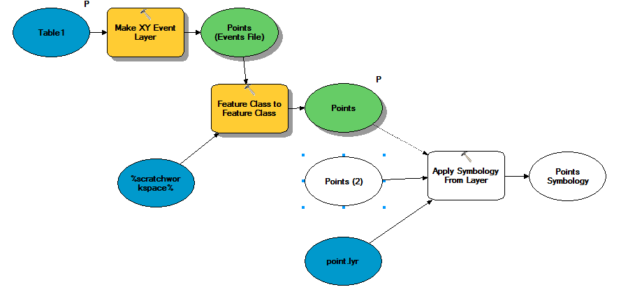
I've created a model that creates an event layer and then a feature class from a table in SQL
the table is updated every 5 minutes and the geprocessing plots the point at its last location according to the timestamp.
It works.
Now I want to see my custom Symbology. I thought that I should add the tool "apply symbology" and then publish the geoprocessing tool with the map server option checked.
The GP needs to be seen on a WAB map.
the model does the following:
create an events layer, creates a feature class in a scratchGDB (default.gdb for the time being). then I want to apply the symbology and I am not sure the parameter are correct:
the problem is that this points feature it does not exits until I create it.
All the time I validate, the points FC disappears.
If i set my FC as a precondition how can I set a non existing layer as a input. I assume the problem is to be found in the scratchworkspace.
How can I make this working?
thanks
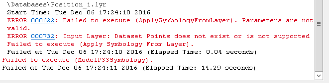
error