Hi,
Is it possible to get a json file from a folder with polyline features through GeoEvent (10.2.2) to a feature service.
I've successful done this for point features, but at a loss how this could be done for other feature types; eg polylines and polygons.
For points my Input is shown below:
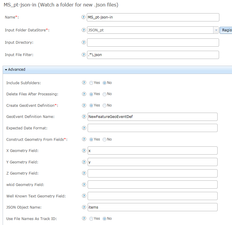
The json text for a point features is as follows:
[
{
"items" : [
{"x" : 114, "y" : -20, "TITLE" : "Ship 1", "SPEED" : 3.0, "COURSE" : 267, "UPDATED_UTC" : 1449479650000},
{"x" : 115, "y" : -20, "TITLE" : "Ship 2", "SPEED" : 2.0, "COURSE" : 203, "UPDATED_UTC" : 1449479650000},
{"x" : 114, "y" : -21, "TITLE" : "Ship 3", "SPEED" : 1.0, "COURSE" : 185, "UPDATED_UTC" : 1449479650000}]
}
]
Regarding the polyline, I can get the fields in but I'm not successful with the actual feature. I'm unsure how to specify the geometry in the input as well as the in the json file.
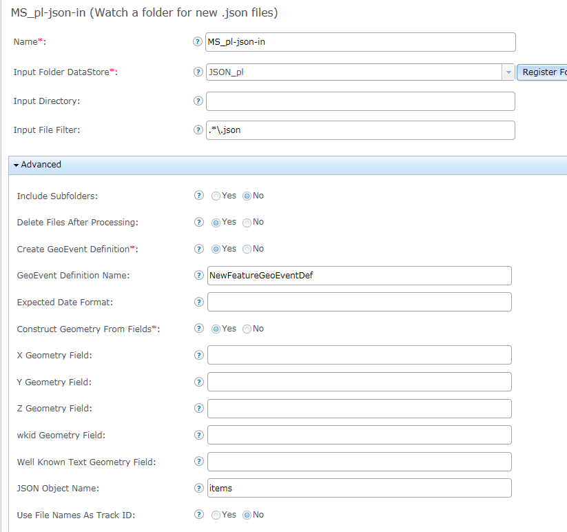
The json file example below:
[
{
"items" : {"paths" : [[[114.1,-20.0], [114.2,-20.0], [114.3,-20.0]]],
"TITLE" : "Hugin Explorer",
"UPDATED_UTC" : 1449479650000
}
}
]
Any help is appreciated.
Regards,
Elliott



