I want to create a simple web app that uses a swipe widget to compare three separate aerial image layers (3 years of imagery at the same location, 2023, 2024, 2025). I want to be able to compare any one layer to any other layer:
2023->2024
2023->2025
2024->2025
Three possible comparisons need to be made. The only way I've found possible thus far is by using the swipe widget in ExB, but in order to pull off that third comparison, 2024->2025, the end user has to figure out a nasty configuration of options made available using the "Allow deactivating layers" options and the "Toggle layer visibility" option.
The "Allow deactivating layers" options cannot be used on its own, because the draw order of the layers in the connected web map will cause data at the bottom of the draw order to be covered, whether layers above are deactivated or not using the blue check boxes the option provides. This option simply does nothing when swiping between layers of the same web map, unless I am confused, which is always possible.
The "Toggle layer visibility option cannot be used on it's own because when 2024 is used both as a leading and trailing layer, toggling visibility as one type of layer (leading) also toggles the visibility for the other (trailing) as well.
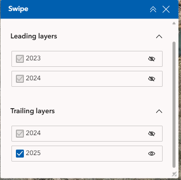
So the only solution I've found to compare 2024 to 2025 is to turn off visibility for 2023 in the leading layers dropdown, while deactivating 2024 but leaving it visible in the trailing layers dropdown. This simply is not a viable solution for end users that are completely unfamiliar with GIS. They will not figure out how to do it.
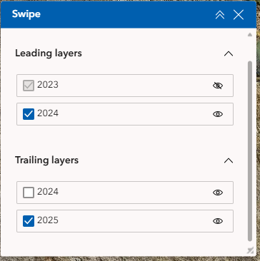
If anyone has nay advice please reply!



