Hello,
I am working with georeferenced historical maps from the 19th century. These are 8-bit unsigned TIF files.
My goal is to create a mosaic in order to merge all the maps into a single raster, so that it can be published on an ArcGIS Enterprise and used in web maps.
I am encountering an issue with color homogenization between each map after creating the mosaic.
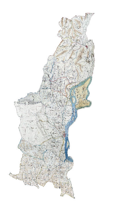
Here is what the maps look like before mosaicking (individual rasters):
After mosaicking:
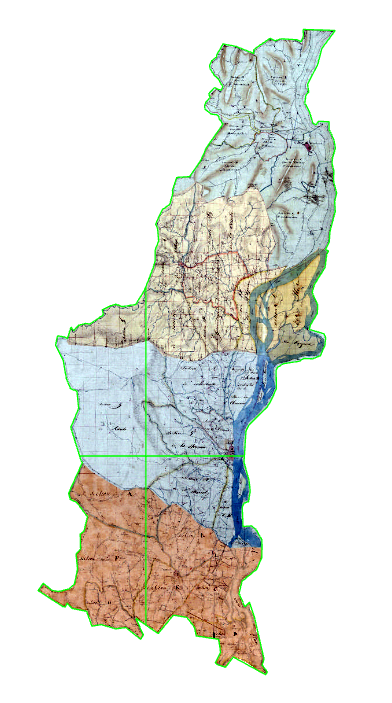
I am wondering why such a significant color shift occurs. The Color Balance function does not change the rendering, and adjusting the Stretch does not truly reduce the differences.
I have also tried, without success:
- Modifying the minimum values to 0 and the maximum values to 254 for the rasters using Set Properties before mosaicking
- Using photo editing software (GIMP) and applying white balance
If anyone has encountered the same issue in the past, I would be happy to discuss it and receive some advice.
Thank you in advance for your help.
Alix CL


