Hello,
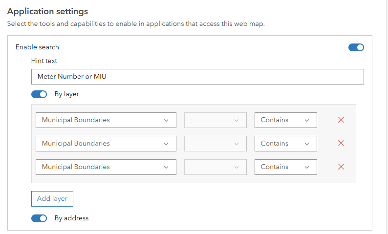
Our water folks are using field maps to update water meter numbers and locations. I set this up about two years ago and it has been a stellar easy to use app. The original setup in the web map under Settings-->Application settings--> Enable search--> By Layer in which I could chose our secured editable water meter layer to search using several fields.
Today I noticed that our secured editable feature service is no longer a choice even though that layer resides in the map. The other layers do show but I don't use those for search. It somehow defaulted to Municipal Boundary layer for my three fields I originally set up for water meter attributes.
Maybe it's our older architecture? We publish on an old GIS server using Pro 2.9 with our database at 10.7.1.
Any ideas what would have caused this or how to fix it?
Thanks,
Shari

