In Pro 3.5.1 (and others) when you run a geoprocessing task, the result is added to the map using what seems to be the symbology applioed to some of the GP inputs.
Quite often Pro gets it wrong due to schema changes from the GP processing so the resulting applied symbology is a mess.
Give us an option to just make Pro dumb and have it load any data using the normal single symbol symbology.
Call it "Add output datasets to an open map without symbology"
Example of the horrors we face:
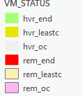
Input layer with grouped values, custom labels, etc:
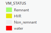
What Pro did to the GP result it loaded: