Hello - I have been using the lovely Terrain Tools for a spat of recent topographic maps with great success, however I ran into some issues regarding the "Cluster Hillshade" function and can't figure out why.

No specific error code, but opening up the details shows this:
'C:\Users\accov\Documents\ArcGIS\Projects\WatershedsCAD\Terrain Mapping.tbx\ClusterHillshade'
isLicensed Syntax Error: File "C:\Users\accov\Documents\ArcGIS\Projects\WatershedsCAD\Terrain Mapping.tbx#ClusterHillshade.InitializeParameters.py", line 21
if inDEM:
TabError: inconsistent use of tabs and spaces in indentation
One thing I noticed is there was no alias for the toolbox, and the name had a space. So I created an alias called "TerrainMapping" to see if that changed anything. No such luck. Another thing is the "isLicensed Syntax Error" but I am logged into my organization with a spatial analyst license (among many others).
So I went into VSCode and looked for anything strikingly obvious, and everything looks decent. There were no errors, and the indents were consistent from my general python knowledge:
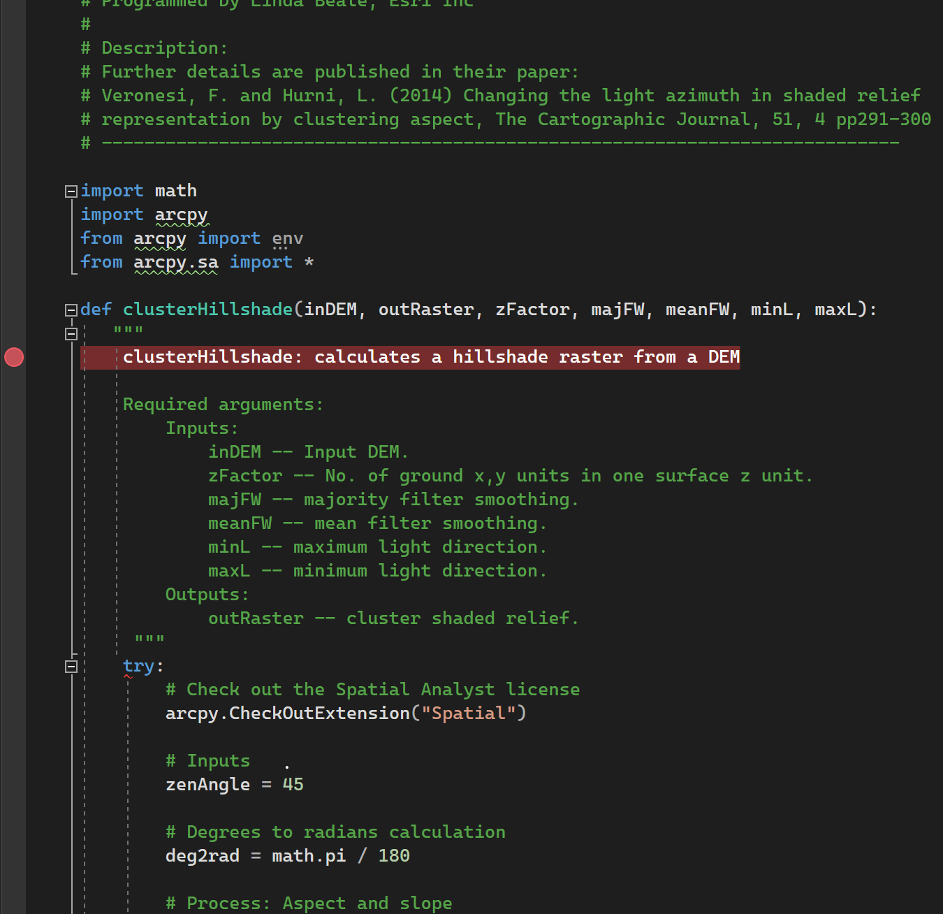
And here is the code sample in its entirety (it's not overly long).
# ---------------------------------------------------------------------------
# ClusterHillshade.py
#
# Based on a technique developed by:
# Fabio Veronesi and Lorenz Hurni (2014) and used with permission.
# Programmed by Linda Beale, Esri Inc
#
# Description:
# Further details are published in their paper:
# Veronesi, F. and Hurni, L. (2014) Changing the light azimuth in shaded relief
# representation by clustering aspect, The Cartographic Journal, 51, 4 pp291-300
# ---------------------------------------------------------------------------

import math
import arcpy
from arcpy import env
from arcpy.sa import *

def clusterHillshade(inDEM, outRaster, zFactor, majFW, meanFW, minL, maxL):
   """
    clusterHillshade: calculates a hillshade raster from a DEM

    Required arguments:
        Inputs:
            inDEM -- Input DEM.
            zFactor -- No. of ground x,y units in one surface z unit.
            majFW -- majority filter smoothing.
            meanFW -- mean filter smoothing.
            minL -- maximum light direction.
            maxL -- minimum light direction.
        Outputs:
            outRaster -- cluster shaded relief.
     """
    try:
        # Check out the Spatial Analyst license
        arcpy.CheckOutExtension("Spatial")

        # Inputs
        zenAngle = 45

        # Degrees to radians calculation
        deg2rad = math.pi / 180

        # Process: Aspect and slope
        AspectDeg = Aspect(inDEM)
        AspectClass = IsoClusterUnsupervisedClassification(AspectDeg, 4, 20, 10)
        # 9.01248403045503E-06
        SlopeDeg = Slope(inDEM, "DEGREE", zFactor)
        SlopeRad = SlopeDeg * deg2rad

        # Process: Zenith and smoothing
        Zenith = Con(SlopeDeg >= 0, (90 - int(zenAngle)) * deg2rad)
        FocalAspect = FocalStatistics(AspectClass, majFW, "MAJORITY")
        MeanCluster = FocalStatistics(FocalAspect, meanFW, "MEAN")

        # Process: Azimuth Calculator
        Azimuth = ((float(maxL) - float(minL)) / 2) * Sin(math.pi * MeanCluster + 1.570796) + (float(maxL) - ((float(maxL) - float(minL)) / 2))

        # Process: Calculate shaded relief
        Shade = ((Cos(Float(Zenith)) * Cos(Float(SlopeRad))) + (Sin(Float(Zenith)) * Sin(Float(SlopeRad)) * Cos((Float(Azimuth) * deg2rad) - Float(AspectDeg * deg2rad))))
        ShadeRelief = Con(Float(Shade) >= 0, 255 * Float(Shade), 0)

        # Process: Save outputs
        ShadeRelief.save(outRaster)
        arcpy.SetParameterAsText(1, outRaster)

    except arcpy.ExecuteError:
        arcpy.AddMessage(arcpy.GetMessages(2))

# End main function

if __name__ == '__main__':
    args = tuple(arcpy.GetParameterAsText(i) for i in range(arcpy.GetArgumentCount()))
    clusterHillshade(*args)
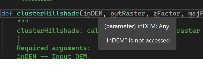
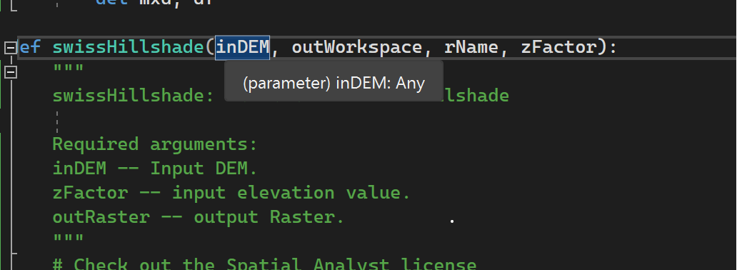
So at the bottom theres the *args that is looking for parameters from clusterHillshade, and I suspect something is going on with the inDEM parameter but that's as far as I can take it. The main hangup appears to be something where "inDEM" is not accessed whereas "inDEM" isn't greyed out for a different script.
if __name__ == '__main__':
    args = tuple(arcpy.GetParameterAsText(i) for i in range(arcpy.GetArgumentCount()))
clusterHillshade(*args)def clusterHillshade(inDEM, outRaster, zFactor, majFW, meanFW, minL, maxL):
"""
clusterHillshade: calculates a hillshade raster from a DEM
Required arguments:
Inputs:
inDEM -- Input DEM.
zFactor -- No. of ground x,y units in one surface z unit.
majFW -- majority filter smoothing.
meanFW -- mean filter smoothing.
minL -- maximum light direction.
maxL -- minimum light direction.
Outputs:
outRaster -- cluster shaded relief.
"""
If anyone has any insight that would be wonderful! Hopefully it isn't just outdated and incompatibly with ArcGIS Pro 3.2.2
Thanks in advance!



