I created a map in Pro, that symbolizes the range of communication towers, in miles, based on an attribute:
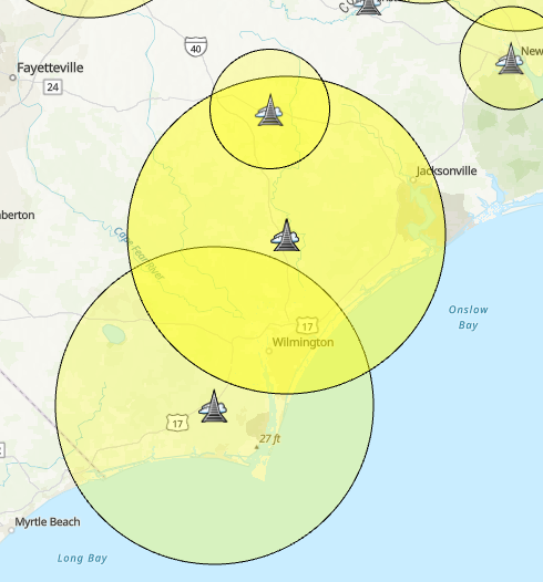
The map has been published to AGOL, but because of how AGOL Map Viewer scales the symbology based on zoom level, the mile range of the towers is no longer symbolized correctly:
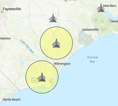
Is there a way to remedy this, so AGOL Map viewer correctly displays the coverage radius?
%2520-%2520Copy.png)





