I am maintaining Waste Management Datasets. There are three different layers, which all have identical geometry. Each area relates to a street location, with collection information on litter type and vehicles for the three Collection Processes, shown below in the Green, Black and Magenta labels (General Waste, Garden and Food, and Recycling).
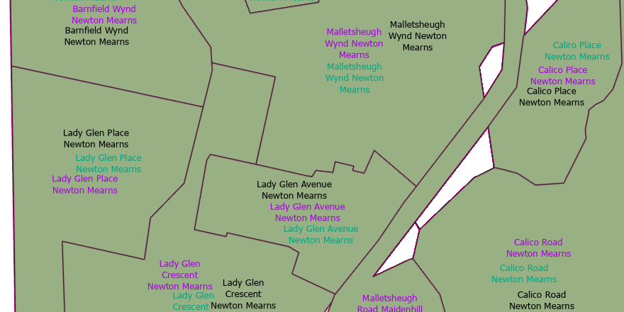
When a street polygon requires to be edited, eg when there is a change in street layout, or new development, then activating Map Topology edits allow the reshape tool in ArcGIS Pro to change the other polygons within the same feature layer and maintains layer contiguity.
However this change needs to be done over all three layers.
Arc Map had the functionality to change the matched topology across multiple feature layers. Does ArcGIS Pro allow this too? If so, how do I do this?
I know that can edit the topology correctly for each layer, but I would rather not have to make changes three times. Can anyone help?
Thanks,




