Hello!
I have a .csv file that contains the following data:
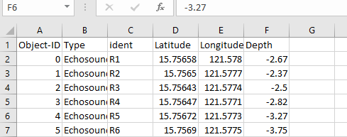
These readings were obtained using a Garmin Etrex 10 GPS with WGS84_UTMZone51N projection.
The problem starts when I try generating points from this file via File > Add Data > Add XY Data. I'm sure I haven't confused the x and y columns and the points are generated on the fly. It's just that they're projected incorrectly. The scale is really small and they're outside the area of interest.
(The coordinate system of the data frame is WGS84_UTMZone51N as well)
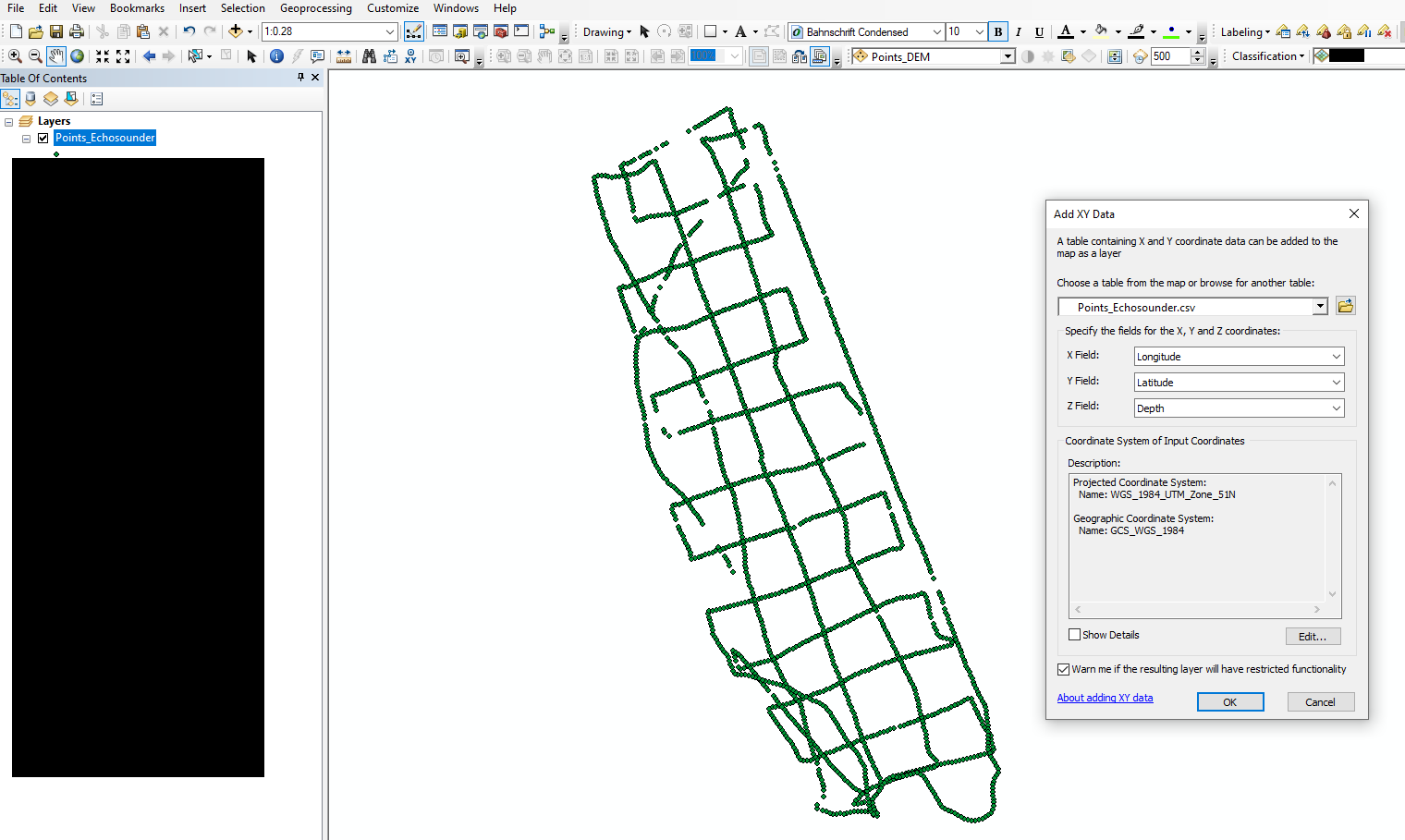
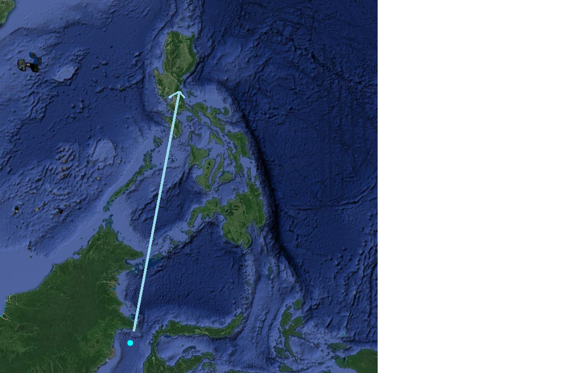
(actual location is pointed)
I can't think of a manual workaround for this as aside from being misplaced, the points are drastically scaled down as well.
HELP.
I'm using ArcGIS 10.5 btw and will use these points in Surfer to generate a seafloor model.
Thanks in advance

